April 16, 2016
On the Hood Canal side of the Olympics, a series of ridges and small peaks form the Quilcene Range and hem in the wilderness areas to the west. Two of these ridges come together and overlap, creating a small pass, or 'Notch'. Long ago this was part of the Native trade/hunting trail system that connected the Quilcene tribes to the interior, as well as their coastal trading partners. The history behind the trail earned it a place on my hiking bucket list.

 The Notch Pass trail starts off fairly steep and stays that way until you crest the Quilcene Ridge, climbing 1700 feet in two miles. It never seems to matter how many trails I hike, I always huff and puff my way up, stopping periodically to catch my breath. Eventually we reached the top of the ridge and made our way over. We then give back some of that elevation as we ventured down the trail into the area where the two ridges meet and overlap, the 'Notch'. As soon as we hit the notch, we knew we had arrived somewhere special. The temperature dropped noticeably, lighting diffused and the 'feel' of the air itself changed. The ambient sounds all but ceased; there was no birdsong, no rustle of the wind in the canopy above ... just the hush of absolute silence. Even our footsteps were muted by the softer trail. The area around us was littered with small trees; damage from past windstorms, however few stumps were visible - they almost appeared as toothpicks dropped from the heavens. The entire landscape reminded me of a scene from the Lord of the Rings trilogy. Eerie yet beautiful.
 |
| Evie enjoys lunch on the banks of the Quilcene |
Once we passed through the notch, the nature of the forest changed; we hiked on a bed of Hemlock cones through salal, Oregon grape and emerging sword ferns. The trail continued downhill, crossing two forest roads, then we had to go up and over another small ridge before reaching our destination - the Quilcene River and Bark Shanty Shelter. There was a boyscout troop at the campsite/shelter, so we went a hundred yards or so downriver to a nice, sunny spot where we dined. All to soon it was time to pack up and start our return journey.
The Notch Pass trail has the distinction of being a trail that is uphill both ways. Everyone in our group did great on the climb back towards the trailhead. We reclaimed the 1300' of elevation we gave back on our descent, our muscles groaning with the exertion. We marveled again at the area of the Notch, then began our steep downward trek back down towards the trailhead where our cars awaited us. By the time we hit the trailhead, everyone's knees and quads had been reduced to rubber. Even so, tired smiles erupted as spirits rejoiced at another great, strenuous hike was successfully accomplished. Our little hiking group rocks!

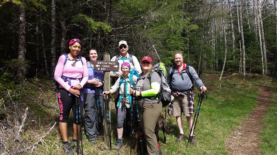 |
| Myke, Andrea, Bill, Me, Evie & Dan |

Hike 16 of 52
Distance: 8.6 miles
Total Elevation gain: 3,000'
Max Elevation achieved: 2,500'
Distance: 8.6 miles
Total Elevation gain: 3,000'
Max Elevation achieved: 2,500'
No comments:
Post a Comment