Wednesday, April 13, 2016

Mount Walker

April 9, 2016

The trail up Mount Walker is a short, very direct route to the summit, where there are two viewpoints - one to the north and Mount Baker, the other to the south and Mount Rainier. With 2,000 feet elevation gain in just about two miles, this is an excellent conditioning route and you are guaranteed a good workout. For this reason, Mount Walker is a popular trail and sees a lot of use. We arrived at the trailhead early to avoid the crowds and our reward was having the summit to ourselves, shared only with a few chickadees and a handful of Gray Jays (Camp Robbers) who flew in hoping for breakfast.


Calypso Orchid

The road was still closed, so our trek started at the gate, which added roughly 1/2 mile to our journey. Our ascent began as soon as we hit the trailhead; the Mount Walker trail gets right down to business with a steady climb and the 20% grade doesn't let up until you reach the top. There are plenty of opportunities to enjoy the beauty of the surrounding forest as you stop to catch your breath. Wild rhododendrons grow here and were just beginning to bud, promising color for June's hikers. We were treated along the way to blooming trillium, smooth yellow violets, and a few beautiful calypso orchids. I love the springtime in the forest!


The unrelenting climb finally ended as we made the summit. The views here were of the Olympics, with the morning sun reflecting off a snowcapped Mount Constance and neighbors, the northern ends of Hood Canal and Puget Sound, with Mount Baker rising out of the clouds in the distance. We rested here a moment, then followed the road to the south viewpoint. Here we looked across Bremerton, Hood Canal, Puget Sound and Seattle, with Mount Rainier standing sentry. Both views are beautiful, but my personal preference is that from the northern point. Knowing that I will be backpacking in July in the area I was seeing in the distance, there in the shadow of Mount Constance, brought about a renewed sense of excitement.

Mount Constance as viewed from Mount Walker

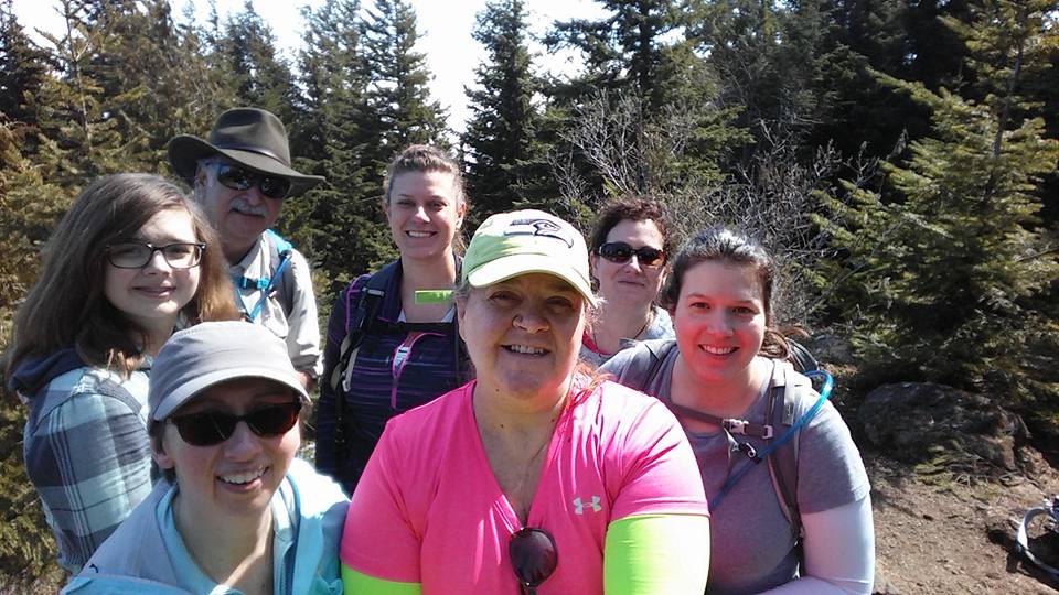
We enjoyed lunch at the southern viewpoint, where we were joined by a view Camp Robbers hoping for a handout. When they realized we weren't going to share, they flew off. It was about that time that we, ourselves, decided to take flight and begin our return trek down the mountain. We snapped our group shot, packed up our gear and hit the trail.

As grueling as the climb up is, the descent is worse. On the way up your thighs, calves and lungs get a thorough workout. On the way down the knees, hips and quads take high impact abuse. By the time we reached the 'sanity' of the road, our legs were talking revolt. In the past I have struggled a great deal with the downs. I won't say I didn't struggle this trip, but I definitely feel a smidge of improvement over this same time last year. 

As a note, from late spring through autumn you can actually drive up to enjoy the views, if you are unable to make the trek up by foot.


Our group; Jeanne, Me, Bill, Dan, Myke & Evie
Hike 15:52
Distance: 5 miles
Elevation Gain: 2,000'
Max Elevation Achieved: 2,804'


Wednesday, April 6, 2016

Rocky Brook Falls

April 3, 2016

What defines a trail? If we look it up in the dictionary we will find:
Trail (noun): a beaten path through rough country such as a forest or moor.

Okay. By that definition, the trail to Rocky Brook Falls is indeed a trail. But, is it a hike? Not really, as a hike is defined as a "long walk in the country or wilderness" and the trail out to Rocky Brook Falls is anything but long. Nevertheless, I have chosen to include it in this blog because it really shouldn't be overlooked, no matter how long or short a walk it is.

Rocky Brook Falls is located just a short 10-minute drive from the trails at Dosewallips State Park, and is probably one of the Olympic Peninsula's best kept secrets. The trail, round trip, is roughly 1/4 mile. You read that correctly, one-quarter mile. 400 yards. Round trip! The terrain is rough near the falls as there are boulders strewn about everywhere - it is, after all, a waterfall. Up to that point, however, it is a leisurely stroll.


The brook itself is beautiful. It tumbles over rocks and boulders like a child skipping down a trail, babbling and singing as it goes. The trail follows it along about half way, then pulls away for a minute as it wraps around the cliff wall. Then, as you pop around the corner to rejoin the brook ... bam! ... You come face-to-face with one of the prettiest horsetail waterfalls in the area. Best payout for minimal effort EVER!


I love sharing this waterfall with friends and watching their faces when they first see it. It truly is a wonder to experience.

Hike 14 of 52 (yes, I'm counting it towards my goal!)
Distance: .25 miles

Tuesday, April 5, 2016

Dosewallips; Steam Donkey / Maple Valley Trails

April 3, 2016


Dosewallips State Park is beautifully situated on the east side of the Olympics, where the Dosewallips River meets Hood Canal. There is a sizeable campground here, where you are likely to encounter elk during the quiet morning/evening hours during the off-peak season. As in many areas of the Olympics, a logging operation was run here in the early 20th century. The campground is situated in the old homestead sites. Also located here is a 5-mile network of trails that offer visitors the peaceful serenity of the forest. It was these trails that Evie and I decided to hike on a bright and sunny Sunday afternoon.


We parked our cars and started our journey along the river. The trail here is called "Maple Valley" and it climbs 400' up the hill from the river into the forest. Benches are placed along the way for reflecting and enjoying the tranquility. The maples for which the trail was named were only beginning to bud, but all around us stately cedar, fir and hemlock stood in quiet repose. Along the way we would encounter evidence of the days when this area was logged; stumps of the grand old growth trees that once stood now played nursemaid to new trees, the roots of the younger trees looking like alien tentacles as they wrap around the nourishing stump towards the ground.

We intersected with the "Steam Donkey Loop" so took that trail. This section of trail was named for the steam locomotives that would haul the trees down the hillside to the water, where they were formed into rafts then taken by tugboat to the sawmill in Seabeck, or loaded on ships. If you take your time and look, you will see remnants of the old rail bed. A wise parent would brush up on the local history and share stories with their children as they investigate the findings. For instance, the rails back then were hand forged and hauled up the hill by mules - really cool stuff.

The trails here, as they loop and intersect one another, offer one amazing sight after another. There are footbridges, a beautiful creek, a few small waterfalls, a pretty little pond, and a tree that actually survived a lightning strike. And all within a five-mile stretch of trail with 400' of elevation gain. Kids can try to count how many different birdsongs they hear, try to identify the different types of ferns that line the trail, dip their toes into Phantom Creek and throw rocks in the river. For us adult-types, there is the blessed state of calm found only in the forest.


I can't think of a better way to spend a Sunday afternoon. Of course, on my way home I stopped at Hoodsport Coffee Company for a scoop of my favorite Lemon Lavender Ice Cream...

Hike 13 of 52.
Distance hiked: 5 miles
Elevation gain: 400'
Max Elevation achieved: 425'
 

Monday, April 4, 2016

Mount Zion

April 2, 2016

Close to a decade ago I climbed to the summit of Mount Zion for the first time. It was summer and I thought I might very well die on the trail up. Then, before I knew it, we were at the top and all thoughts of a trail-induced death vanished. I have made the trek up a half dozen times since. As it was my first summit, it also became my grandson's first summit, as well as a handful of friends.

The trail up Mount Zion isn't overly steep, but climbs steadily and consistently uphill, covering 1300 feet in just over 2-1/4 miles. It's just steep enough to suck the air out of your lungs and give your thighs a good workout. Due to the popularity of nearby Mount Walker, Mount Zion is somewhat overlooked, which meant we would pretty much have the trail to ourselves for the majority of our hike. This fact added to the intermediate grade of the climb was precisely why we ventured out on this trail.

Our adventure began on the drive up through the thick low-lying cloud cover. After a few miles of poor visibility (nothing like trying to dodge invisible potholes) we finally emerged out of the clouds into skies that were clear and blue. The morning sun lit the surrounding landscape and promised us a spectacular hike. We parked at the trailhead, donned our packs and began our trek. If you hike this trail in late-May/mid-June, you will be hiking through a cathedral of pink wild rhododendrons; alas, we were too early for the show. Instead, we were blessed with peek-a-boo views of snow-covered Mount Townsend and Mount Hamilton to the southwest, as well as other peaks too numerous to name here (I couldn't name them all anyhow...).

This trail doesn't possess many switchbacks, instead it leads you rather directly to the summit. We hiked through second growth forest (a fire burned through here decades ago), huckleberries, salal and wild rhodies. After a few pauses to catch our breath, we made it to the top. The summit itself was once home to a fire lookout, which was removed in 1975. It's evident why they built one there - the easterly view from Mount Zion looks across Puget Sound (which was heavily cloaked in clouds) to the Cascades. To the west, before the trees took over, you could once see across the northern portion of the Olympics. Sadly, I didn't get any good photos of the view to share.

There was a wee bit of snow left on the summit, in which the youngest of our group and our canine companions played. For many of the group this was their first mountain summit - as it was mine a decade prior. Zion holds a special place in my heart and I love sharing her. As we immersed ourselves in the moment, and the view, we ate our lunches. Eventually it was time to pack up and head back down. The downward journey is always harder on the joints than the trip up, and the Mount Zion trail was no exception. By the time we reached the cars our knees were voicing their displeasure at the abuse.

If you are in reasonable condition and would like to hike to the top of a mountain, I highly recommend Mount Zion and encourage you to make the trip to Quilcene. It's worth the effort. This is, and always will be, one of my favorite trails.
 
Our Summit Group;
(Clockwise) Lauren, Bill, Annalise, Lelani, Andrea, Evie, me


Zillah & me at the Mount Zion summit
Hike 12 of 52
Distance: 4.2 miles
Elevation gain; 1,300'
Max Elevation Achieved; 4,274'

Monday, March 28, 2016

Lower Lena Lake

March 26, 2016


Sometimes it's nice to re-hike a trail that has given you trouble in the past to check your current level of conditioning. This was one of those instances. I have hiked to Lower Lena Lake a handful of times, and each time I have huffed & puffed my way up, having to pause to catch my breath along the way. The trip down has vexed my knees, hips and quads. It's not a difficult trail - in fact, it's rated as appropriate for kids - but it has a steady and continuous elevation gain of 1300 feet in 3.6 miles. It's just one that has given me trouble.

photo by Holly Scheyer
This week's trip up to Lena Lake was under partly sunny skies. The trail is becoming very popular, thus is seeing heavier foot traffic, but it is well maintained and still in fairly good condition. It "meanders" (a polite term for switchback after switchback) up through a beautiful old growth forest. The trees here are easily 100 feet tall, rising impressively above the forest floor, as if reaching towards the heavens. Even with all this beauty surrounding us, there was also evidence of our recent wind storms. Trees were down across the trail; one stately giant snapped off and, as it fell, uprooted two other large trees, who then broke off another tree further down the hill. Like dominoes they took each other out, leaving splintered stumps, unearthed roots and debris behind. It was dramatically awe inspiring to be witness to the forces that had been at work here.

This trail continued upward as well, pushing not toward heaven, but to our destination - Lena Lake. It led us past one of the largest boulders I've ever seen, left behind by the glaciers that once covered this area. It took us over a dry gulch where a stream once bounced over boulders - this creekbed hasn't seen water during my lifetime, but indications of the water that once flowed can be seen. It also carried us over an active stream, and alongside a small waterfall where it cascades down the mountainside.


After executing 15 switchbacks and a couple doglegs, we finally arrived at the upper viewpoint of the lake. Lena Lake sits in bowl created by three surrounding mountains of the Brothers Wilderness. Her banks are steep, mirroring the terrain of the mountains that encircle her, making her much deeper than she appears from the surface. We sat there at the overview, soaking in the surrounding beauty and enjoying lunch. After lunch we took a side trail down to the lakeshore where we wondered at the steep banks, laughed and played on the massive tree roots and logs, and cast off any remaining stresses from our daily lives. Eventually it was time to head home, so back to the main trail we went, then on down to the trailhead.

I was pleased that I experienced none of the difficulties of past trips. I didn't have to stop for breath, nor to give my legs a break - signs that I am becoming stronger. I can see growth not only in myself, but in my hiking partners. They continue to improve in condition as well. Zillah accompanied us and continues to develop into an awesome trail dog. All in all this was a great day.

Zillah, Me, Myke, Dan, Andrea, Shelby, Evie & Bill (Holly behind lens)
Hike #11 of 52.
Distance: 7.2 miles
Elevation gain: 1,300 feet / Max elevation achieved; 2,000 ft.


. 

Monday, March 21, 2016

North Fork Quinault

March 19, 2016


Last weekend the PNW was hit by extremely high winds. The coastal areas were hit the hardest. Our group decided to play it safe and cancelled our planned hike. We stayed indoors, hunkered down and waited out the storm. As we listened to news reports in the days following the storm, we were glad we did. Heading out on this week's hike, I wasn't sure what we'd find on the trail, but knew our group could tackle most any obstacle that may lay ahead.

Our plan was to hike the Graves Creek trail; a pretty seven mile trek through the Quinault rain forest with about 1200 feet of elevation gain. However, the road was closed about six miles from the trailhead due to a major washout. We hauled out our trusty guidebook and located another trail just a few miles up the other side of the river - the North Fork Quinault trail. The trail distance was comparable, with a bit less elevation.

Evie on the North Fork Quinault trail
The portion of the trail that we travelled was once part of the Press Expedition's 1889 route across the Olympics, and followed an old roadbed that had long ago been abandoned due to the cost to constantly maintain and rebuild it. The Quinault River rages high during the winter and with spring runoffs and frequently jumps its banks, continually changing its course. About 5 miles up the trail is the site of a former lodge, however we weren't headed that far this trip.

A short way up the trail we encountered the first evidence of how strong the windstorm that hit the coast truly was. A beautiful cedar, who's trunk was over 4 feet in diameter, lay across the trail, uprooted by the gales. We are accustomed to encountering smaller trees across the trail from time to time, but seeing one this size was humbling. We climbed up and over it, and continued up the trail to the next downed tree, and the next. There were a few small creeks to cross, a marshy area, and a large rocky wash, none of which caused us much difficulty.

Before we knew it we had arrived at Wolf Bar Camp - our lunch destination and turnaround point. It was peacefully quiet there among the trees on the riverbank - the only sound that of the river and a lone songbird serenading from its perch above us. We weren't the only ones there for lunch - a few early season mosquitos pulled in and started dining on Evie, so after watching her aerobic bug-swatting workout, we packed up for the return trip.

Evie making her way across a stream and under a downed tree


Storm damage - Snapped Hemlock (3' dia trunk)


This really was a nice trail, easy up to the camp (400 ft gain). Any readers wanting to hike this trail should be prepared for the downed trees and marshy area - and bring bug spray.  The highlight of this hike, I think, was the three herds of elk we encountered near the trailhead. They were majestically beautiful. I fully intend to do this one again next year with my grandkids. By then the trees should be cleared.


Maddy, Me, Evie, Andrea & Bill in front of the ranger station
Hike #10 of 52.
Distance: 5.2 miles
400' elevation gain


Tuesday, March 8, 2016

Lower Gray Wolf River

March 5, 2016

Last week we hiked along the Dungeness River. This past weekend we hiked the lower section of the Gray Wolf River, which feeds into the Dungeness. Together they flow through the Buckhorn Wilderness area of the Olympic Range, into Dungeness Bay and on out into the Straight of Juan de Fuca. I hiked this trail last year - in fact, it was on this trail that the decision to return to Mount St Helens was made. I have looked forward to re-hiking this trail, partly because of the beauty of the river, and partly to give my current level of conditioning a check.

This isn't a difficult trail, although it is far more than an easy stroll through the forest. It starts out with an 800' descent to the riverbank, followed by an 800' climb up and over a beautifully forested ridge, and back down to the river. The up and over is accomplished in one mile, so is a definite work-out. The reward awaiting you on the other side is some of the prettiest riverside trail you're likely to hike. There is an established campsite that invites you to sit, linger, and enjoy the sound of the river as it sings its soothing lullaby. And sit we did. We each found ourselves a section of log and pulled out our lunches. After eating we explored the river's edge, took some photos and, in my case, fell in. Even now I can envision the expression on my father's face as he would have shook his head in wonderment at what a lack of grace his petite little girl possessed. It was a good opportunity to check the water resistance of my boots and effectiveness of my gaiters. I'm happy to announce that my feet stayed dry ... and that I do not walk on water.

We hit the trail again after our lunch break. Just up the trail a bit the water takes on the most beautiful color of light blue-green. The sun had finally broken through the clouds and bathed the forest in a shower of color - the greens and yellows of a dormant forest against the blue-green of the river was stunning. I really must return to hike this trail during the summer some time, as I can only begin to imagine how beautiful it must be.

The trail steeply climbs again for a short distance. At one time it took you to a high footbridge that crossed the river, but it was destroyed in a flood back in 1990, so the trail ends here. It's amazing to stand there, looking down at the river as it rushes through the narrow channel, and not be able to see any evidence where the bridge once stood, as nature has fully taken over. Holly and I made the trek up to that site, then turned around and joined back up with the rest of our group who chose not to make the additional climb.


Our return trip seemed to take forever, because this trail has the distinction of being uphill both ways. If our legs muscles weren't tired before, they were now. Everyone did great, even the member of our group who was experiencing some significant knee trouble. Once back at the trailhead, we shot our group photo, loaded into our vehicles and headed home, calling it a day.


I didn't use my trekking poles on this trail because I really wanted to see the difference in my performance over last year's hike. Looking back, my knees and quads faired better, but I am still having trouble with my hip flexors. A trip to the massage therapist is on my list.


Hike #9 of 52.
Distance hiked: 8.6 miles
Elevation Gain: 800'
Max Elevation achieved: 1500'