June 11, 2016
This weekend we hiked a combination route of Iron Bear & Teanaway Ridge trails, a route which takes you to an unnamed peak commonly referred to as Iron Bear Peak. It is located east of the mountains in the Wenatchee National Forest. We largely hike on the west side of the Cascade Range, so I enjoy the occasional junket east. The views, terrain, and even smells are different from what I normally encounter. This was a return trip for me, so I was able to relax and enjoy the journey a bit more.
 |
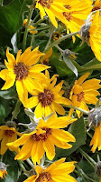
| Balsamroot |
The route up to the summit isn't overly difficult or long; I'd rate it as moderate. The elevation gain is steady with minimal switchbacks - a blessed relief from our past few hikes. The weather forecast for Seattle called for rain showers, but on the eastern side of the range we had partly sunny skies. It was perfect hiking weather, and the summit was calling me.
 |
| Scarlet Gillia or 'Skyrocket' |
The wildflowers were in bloom; we strolled through the bursts of color provided by Starry Solomons Seal, Columbine, Paintbrush, Lupine, Balsamroot and Scarlet Gillia, to name just the most prominent performers. Their yellow, white, crimson, blue and purple colors really popped against the browns of the rocks and soil. The wild roses and serviceberry blossoms were fragrant and their perfume mingled with the aroma of the lodgepole pine, treating our noses to a delightful symphony of scents. I was in a sensory heaven!

The trail wound around and came to a junction with the second half of our adventure, the Teanaway Ridge trail. Up to now we had been following the Iron Bear trail, which continues along the ridge. Our journey today, however, was to the summit that awaited us at the end of Teanaway Ridge, so we made a hard right and resumed our upward trek.
As we climbed higher along the ridge, the scenery changed. The trees thinned out, giving way instead to low-growing shrubs. The shapes and colors of the rolling hills and ridges, with their patchwork of forests, clearcuts and farmland unfolded around us like a quilt. The clouds in the sky would blow in on the breeze, then clear, then move in again, building on themselves in layers.
 When we reached the junction with the Iron Bear trail, we stopped for a quick break. The sun had returned, so we were able to warm up and remove layers. With the ridge somewhat protecting us from the winds, I unpacked my little trail stove and Holly unpacked the fixings for s'mores! To the amusement of the other hikers on the trail, we roasted marshmallows over the flame of my stove and indulged ourselves in a special trailside treat. We have been hiking increasingly difficult trails for the past five months, so I felt we deserved a reward in the form of a little guilty pleasure.
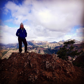
By the time we reached the summit, the winds had picked up in earnest, and the clouds had moved in, seemingly to stay. We pulled our warm layers out of our packs and ate lunch while enjoying the views of Mount Stuart and the Stuart and Wenatchee Ranges. We stayed until we started getting cold, then began our journey back down the trail.
 |
| Our group at the summit (clockwise: Josef, Tony, Lisa, Bill, Holly, Me & Andrea) |
 When we reached the junction with the Iron Bear trail, we stopped for a quick break. The sun had returned, so we were able to warm up and remove layers. With the ridge somewhat protecting us from the winds, I unpacked my little trail stove and Holly unpacked the fixings for s'mores! To the amusement of the other hikers on the trail, we roasted marshmallows over the flame of my stove and indulged ourselves in a special trailside treat. We have been hiking increasingly difficult trails for the past five months, so I felt we deserved a reward in the form of a little guilty pleasure.
Once we reached the trailhead, I was able to look back on the hike and smile. Everyone did great. The good weather held for us. This trail was less difficult than the last few we had done, and our bodies seemed to appreciate the breather. My own body performed well, assuaging some of my doubt and wavering confidence from last week. Iron Bear will always be one of my favorite trails.
Hike 27:52
Distance: 6.5 miles
Elevation gain: 1900'
Max Elevation Achieved: 5,063'
Hike 27:52
Distance: 6.5 miles
Elevation gain: 1900'
Max Elevation Achieved: 5,063'


No comments:
Post a Comment