Wednesday, June 29, 2016

Lake Valhalla


June 25, 2016


Lake Valhalla. Just the name alone conjures up images of Vikings, Norse gods, and mythical places. How could I not go visit such a beautiful sounding place? I didn't plan on encountering any gods or valkyries, but I did hope for an adventure to a place worthy of such as esteemed name. I wasn't disappointed.


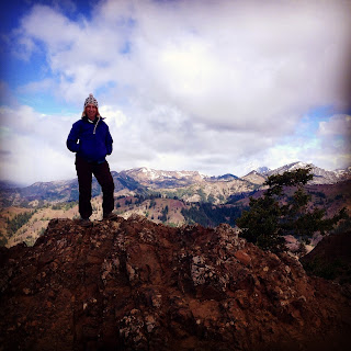
Celebrating my arrival on the PCT!
Our voyage began on the well-used and well maintained Smithbrook trail, which modestly climbed upwards, leading us to a place called Union Gap. It was here that we turned southwards on a section of the PCT (Pacific Crest Trail). It has long been a goal of mine to hike all 2650 miles of the PCT, so stepping onto the trail was momentous for me. We followed this portion of trail for another two miles, gradually carrying us up, over and around the ridgeline. We hit some snowfields and downed trees along the way, but nothing we couldn't handle. 

Evie & Myke make their way across a snowfield
We rounded the edge of Lichtenberg Mountain and there, in a cirque at the bottom, was Lake Valhalla. We stopped in our tracks and gasped at the beauty. I don't know what my readers' beliefs are, but I believe in an almighty God ... and scenes like this remind me of how magnificent He is. I found myself, once again, in awe.


It took us a few minutes to find the route down to the lake, as the trail was pretty much covered in snow the rest of the way down. Eventually we arrived on the south shore, which is where we stopped for lunch. The lake is bordered by the imposing Lichtenberg Mountain to the east and on the west by Mount McCausland. The lake seems to drop off the horizon to the north, where the two mountains meet. There are a couple backcountry campsites on the north end that I intend to come back and utilize. 

 
Lake Valhalla

Dan & Myke share a tender moment lakeside


Lichtenberg Mountain

Evie at Lake Valhalla

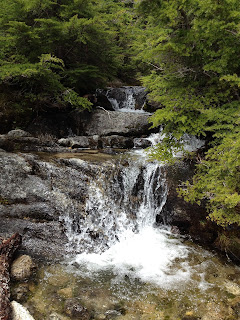
As we ate lunch, we watched a school of trout swim in the crystal clear waters, possibly enjoying the warmer shallow water close to shore. A small waterfall added its quiet song to the ambiance. An occasional bird tittered in the nearby trees. We each took a host of photographs before begrudgingly donning our packs and bidding the lake adieu. The popularity of the lake became evident as we were packing up by the dozen or so hikers that showed up as we were leaving. Our trek back to the trailhead was uneventful and my knees appreciated the moderate elevation of the trail.

Lake Valhalla was indeed worthy of its name, a place held by the Norse God Odin. It was truly a place of mystical and mythical beauty. I look forward to returning.

Hike 31 of 52
Distance: 7 miles
Elevation gain: 1500'
Highest elevation achieved: 5050'


Tuesday, June 28, 2016

Packwood Lake

June 22, 2016

I found myself in the position of needing to take some unplanned vacation days, thus scheduled a few mid-week days off in upcoming weeks. I was faced with a choice of catching up on house and yardwork, or hiking ... suffice it to say it took me a nanosecond to decide - I would be answering the call of the trail. My first mid-week hike found me driving southeast to the sleepy little town of Packwood, Washington. I would like to interject here that if you are not a Verizon customer, you will have no cell phone service. This posed a wee problem, as I needed to access directions to the trail. I am usually better prepared, but my previous download of trail info had failed and I was at a loss. If you ever find yourself in Packwood, please stop at Blanton's Market and throw a little business their way. Their employees are some of the friendliest folks you will ever meet - my checker gave me directions, current road/trail conditions, and advised an alternate route to the lake that would give me good views along the way. They also provide free maps of the area.

Once I was on my way, I found myself on one of the nicest forest roads I think my poor Mustang has ever travelled down. The parking area was large, giving hint to how popular this trail likely is on weekends. Even mid-week there were a half dozen cars in the lot. Zillah and I relieved ourselves in our respective toilets (Zillah pees on bushes, I tend to prefer outhouses), then followed the advised route out of the parking lot to the livestock/motorized vehicle trailhead. The trail here followed an old roadbed thus was wide, well maintained, and reported to have easier gain. 

Greenery along the Packwood Lake trail

The scenery on the lower trail was gorgeous. Zillah and I walked through greenery of every shade and hue. There were small waterfalls along the way, which likely dwindle and dry to nothingness later in the season but flowed freely for us. There were peek-a-boo views of Mount Rainier and some of the other local peaks. Off in the distance we could hear the running water of a creek. We encountered four other hikers along the way, one with a young dog in training, otherwise had the trail entirely to ourselves. It was bliss.


Cable car suspended over the creek


Before long the trail carried us closer to the stream that had been talking to us along the way. Zillah waded in it, drinking and splashing in the coolness of its water. She can be so silly and puppy-like! As we walked along the creek, we encountered a suspended wooden cable car, which is used to transport supplies and equipment across waterways via a pulley system. Just a short way past that, we came to a small dam, which warranted some closer investigation.

The outlet from the lake was the most spectacular shade of turquoise green. A wooden bridge crosses where it exits the lake, making for a beautiful image. As beautiful as this sight was, it didn't prepare me for what lay beyond. We walked around the corner and over a small rise and ... Wow. Just wow.

Packwood Lake


I stood there, immersed in wonderment and awe at the landscape before me. Packwood Lake was an indescribable shade of green. There is an island in the center that is bursting with evergreens. Snow-topped Snyder Mountain rises behind, offering itself as a majestic backdrop to the grand image.

After eating our lunch on the shores of the lake, Zillah and I explored the area. The wooden bridge I had seen earlier, crosses the outlet and connects hikers with the trail to Lost Lake - an adventure to be had another day. There is a circa 1910 Ranger station there that is in the restoration process. I was saddened to see someone had broken out a few of the windows and had pried locks in an attempt to break in. I don't know what's wrong with youth today, but their lack of respect angers me.


The mosquitos had turned out in force, so I sprayed myself with the last of my DEET in an effort to stall their attacks. Zillah was busy chasing a chipmunk that had the wherewithal to actually run across her tail. A gentleman rode past with his horses, reminding me that this is a true multi-use trail. Although I was enjoying the solitude, it was nice knowing we weren't the only ones out there. I donned my pack, whistled for Zillah, and headed up the upper trail.


Any elevation on the trail to Packwood Lake will be found on the upper trail. We started out climbing up and away from the lake, and headed into the Goat Rocks Wilderness; an area I can't recall having ever hiked before. The trail here totally differed from that of the lower trail. It was rockier and not as lushly green as its lower counterpart. The mosquitos were thick and only slightly deterred by my repellent. The air felt drier. As we hiked, the forest grew thick enough that it blocked the light, casting the understory into near darkness. Only filtered rays made it through, giving the trail the feel of enchantment. Few birds chirped high above us and, somewhere off in the distance, we could faintly hear frogs. On the lower trail our faces had been kissed with a gentle breeze; up here the air didn't move. It was an odd contrast.

We made it back to the parking lot, now all but empty. I poured Zillah some water before we climbed into the Mustang, shutting the doors and putting her into drive. I don't solo hike often. I was so happy to have chosen such a nice trail to venture out on alone, just Zillah and I. With the minimal elevation of the trail, it was exactly the break my body needed - I have been pushing myself pretty hard lately. It was a wonderful way to spend a vacation day, and I look forward to returning to explore the area further.

Hike 30 of 52.
Distance: 10 miles
Elevation gain: 600'
Max elevation achieved: 3200 ft.


Tuesday, June 21, 2016

Mount Pilchuck

June 19, 2016

Some trails will always be dear to my heart, and the trail to the retired fire lookout atop Mount Pilchuck is one of them. It's not a long trail, feeling longer than it really is. Although not rated as difficult, it's just difficult enough to make it challenging. On a clear day, the views are spectacular. It also holds the distinction of being the first trail I ever helped maintain with the Washington Trails Association - we replanted sections where folks had gone off-trail and destroyed a few delicate areas. When an alpine area is damaged, in this case from human over-use, it can take decades (or as much as hundreds) of years to restore itself. The WTA will work with local forestry agencies, botanists and volunteers to help nature out and speed that process up a little. I was, and remain, proud to have been part of that process.

Our intention, this Father's Day, was to hit the trail early to more or less have it to ourselves for a bit. However, due to a slight snafu with ferry schedules, we weren't actually on the trail until almost 9:00. By then the parking lot was 1/4 full. Although the weather the previous day had been for snow at the summit, the forecast for this day was mostly sunny skies. With great excitement and anticipation we hoisted our packs on our backs and started up the trail, Zillah at the lead. This dog loves to hike and I've only known her to show reluctance about a hiking adventure once; her exuberance today was almost infectious.

The trail starts out moderately, with large rocks making an almost immediate appearance, a mere hint at what lay in wait on the trail ahead. The snows higher up were melting, sending a steady stream of water down the trail. In places we were hiking through water about an inch deep, in others through thick mud. We splashed, squished and 'schlucked' our way up the trail, through a lush forest. Varied Thrush whistled their greetings, welcoming us to their home. The air was crisp and the sky looked promising. All around us buzzed annoying gnats, enjoying the cool, moist air under the trees.

The trail grew difficult to follow as we came to the first boulder field. So many hikers had taken small side trips off-trail that we followed the wrong course; instead of heading over the top of the field, we took a lower route. Zillah was let off-leash so neither of us would risk harming the other should one of us slip. As we were stopped trying to re-find our route, we caught sight of hikers on their return trip down the trail ... way above us. It was then we realized our mistake and turned around. I lost my footing on a wet moss & lichen covered boulder and down I went. I landed smack on my butt, hitting my forearm on the boulder with the impact. After an emphatic "Ow!", I laughed as I thought to myself "That one's gonna leave a nice looking bruise." I regained my footing and made my way to where the rest of our group, who had made their way back to the trail, was waiting, worriedly watching my progress.

From that point, the trail gets steeper, rockier, and more challenging ... and, thankfully, bug free. This trail sees so much use that any gravel hauled in by the WTA has long-since been swallowed up by the trail. The manmade steps, once filled with gravel, were now hollowed out frames for exposed boulders and mud. Alongside the trail lay the remains of an old tramway, a glimpse into a bygone era and a nice distraction from our steady climb. We continued up through subsequent boulder fields, stepping up, over and around boulder after boulder. Interspersed between the boulder fields were snowfields. They were rapidly melting so had become a slushy, slick and wet mess, worsened by the number of people traversing them (many in running shoes).
Pilchuck boulder fields (photos by Evie Osburn)
As we climbed, the clouds gave us altering views of the surrounding landscape. We had periods where we were hiking through wispy, mist-like clouds, casting an eeriness to the trail. The clouds would build and thicken, then break apart, bathing the slopes in sunlight. The breeze would swirl around us, carrying the clouds back in and cloaking us again in their cover.

We finally made it to the summit. The lookout is perched atop some large boulders. To access it you have to scramble up the boulders, then climb a ladder. There were dozens of people trying to navigate the boulders, both up and down at the same time, with no heed for anyone's safety. We split our group of four in half - two went up first while the other two ate lunch with Zillah, then we swapped.
Evie makes the final ascent
The clouds were determined to stick around for our stay, obscuring our view of the Cascade Range. They also ensured the temperature stayed in the crisp range of 40-42 degrees. Every so often the clouds would move aside just enough to give us a teasing peek of the view they were hiding. We didn't stay up there long, as there were more hikers showing up by the dozens. We decided to leave before it got dangerous due to over-crowding, especially since more dogs were showing up as well. Zillah is well-behaved and has good trail manners, but such is not always the case with other dogs we encounter.


On our trip back down the mountain I slipped on the slick snow and again landed on my derriere. There was no way I was getting on my feet without risking a dangerous slide into the trees, so I took advantage of my sitting position and slid to where I could safely stand upright. Talk about fun! Sadly, that was the end of my fun for the descent. My knees, quads and hips didn't want to hold my weight with each step down I needed to take - I found myself supporting myself on my trekking poles and lowering myself down over each boulder. It was slow-going, painful and frustrating. I don't understand why I appear to grow weaker with each hike instead of stronger. Nobody else in our group seemed  to have any difficulty. I have an appointment to discuss my concerns with my doctor.


Everything that goes up must come down, and that includes little old ladies who hike at a snail's pace. After what seemed a small eternity we found ourselves back in the bug-cloud, which meant we were close to the car. I inhaled a few gnats for the extra protein, huntress that I am, and finished my hike with a half-hearted 'Rocky' jog off the trail. It was a long day but, my own frustrations aside, a good day. It saddened me to see the area we replanted a few years ago, which was lush and healthy this time last year, destroyed again. Visitors to the historic lookout have defaced it with graffiti. The erosion of the trail due to the sheer number of people who hike it was alarming. I was able to notice a difference since I last hiked it a year ago. The trail to Mount Pilchuck holds a special place in my heart, and always will, but I love it too much to return. I don't want to contribute to its demise. Perhaps I can return as part of another work party to rebuild her.
Me & Evie at the Lookout

Hike 29:52
Distance: 5.4 miles
Elevation gain: 2300'
Max elevation achieved: 5,327 ft.


Monday, June 20, 2016

Navigating the Urban Jungle

June 18, 2016


The weather forecast for the day was gloomy at best. Clouds. Heavy rains. Thunder. The forecast for the mountain we were scheduled to hike up called for as much as 2 inches of snow at the summit and heavy rains for the climb. Although I most certainly do not melt in the rain, the thought of navigating a boulder field and attempting the scramble to the summit in snow and poor visibility didn't appeal to me. Color me chicken if you wish, but I like this whole 'life' thing and have grown rather dependent on breathing. It was decided, therefore, to push the hike off a day. That left me with time on my hands and zero desire to clean house. I needed a few items from REI and decided a trip to the flagship store in Seattle was necessitated. As Evie had never been to the flagship store, and rarely visited Seattle, I sensed the opportunity for an adventure.


Evie lives in North Kitsap, so we met at the ferry terminal in Bremerton, where we walked on the ferry. Let me re-phrase that... we misread the schedule so ended up RUNNING onto the ferry, trying not to spill our Starbucks as we jogged our way down the ramp. Laughing about the mistake, we found seats and enjoyed the conversation of friends. The Bremerton-Seattle run takes roughly an hour, so there was plenty time for girlish giggling, updates, life stories and stress-relieving venting.


Once we arrived in Seattle, we looked up at the sky, pleased that it was only grey, and not overly threatening. We then began our trek uphill (as most treks in Seattle are) to the opposite corner of downtown. My mother worked downtown Bon Marche' (now Macys) throughout my childhood and I spent a great deal of time exploring the streets - which was safe to do in the 60's. I shared stories about changes I'd seen, historical facts and trivia. We stopped at a Starbucks (they suck you in like quicksand, they do), then laughed when we encountered another one two blocks down.We zig-zagged our way along the city streets towards our destination. Along the way we met a dog named Charlie who was taking his human for his daily walk. I strategically routed us so that we entered through their main entrance, which requires shoppers to wander through a beautifully landscaped 'forest', complete with trails and a waterfall.


I watched with great pleasure the look of amazement on Evie's face as we finally walked through the big double doors. It was like seeing Charlie's face when he took his first steps into WonkaLand. Now, Evie and I each have an REI store near our homes where we typically shop, but they don't hold a candle to the Flagship store. She wanted to hit every display ... and we did. After two hours we had only made it through about half the downstairs, but both budgets were pretty much maxed out, so we headed towards the cashiers. I would like to point out that I had four must-have items on my shopping list, and I left there with precisely zero items on my list. I do, however, now own an awesome backpacking chair on which to rest my butt and a waterproof headlamp, the later of which I am assured will endure our PNW rains out on the trail.

From REI we wandered west towards our lunch destination, which was directly across the street from Cactus, which offers incredible southwest cuisine. Without so much as a second thought, we made a sharp bee-line. They have decent gluten-free items on their menu, my selection from which paired nicely with a mint-ginger beer drink.

After lunch we again headed west towards the water. Shortly thereafter the skies opened up with a deluge. Fortunately the planners who designed the older buildings downtown engineered sizeable overhangs on a large number of the buildings, which meant we were able to mostly stay dry. With each block we travelled, the rain fell harder. As we faced a block with no overhang (oh, the horror!) the decision to call Uber was made. We were entertained by a wonderful street musician while we awaited our ride. It was during this time I came to the revelation that every fifth car in Seattle is a Prius. Way to counter my oversized carbon footprint, Seattleites! By the time our Uber ride found us, the rains had subsided and the sun began to peek through the clouds. Such it is with weather in Seattle.

Our driver was great and had us to Colman Dock in no time. We were making our way up to the passenger terminal as they announced the last call for Bremerton. We looked at each other and launched ourselves to the ticket kiosk, made our way to the turnstiles then sprinted down the ramp to the ferry, laughing all the way. They closed the rails right behind us and the boat was underway before we even found seating. Our ride back across the water was filled with talk of upcoming hikes, our July backpack trip, and initial plans of another pack trip in September. We both expressed our enjoyment of our 'hike' through the urban jungle of Seattle. Before we knew it, we had docked on the west side of the sound and it was time to bid each other farewell ... until tomorrow.


Hike 28:52
Distance: 3.5 miles
Elevation gain: approx. 275' 

Wednesday, June 15, 2016

Iron Bear

June 11, 2016


This weekend we hiked a combination route of Iron Bear & Teanaway Ridge trails, a route which takes you to an unnamed peak commonly referred to as Iron Bear Peak. It is located east of the mountains in the Wenatchee National Forest. We largely hike on the west side of the Cascade Range, so I enjoy the occasional junket east. The views, terrain, and even smells are different from what I normally encounter. This was a return trip for me, so I was able to relax and enjoy the journey a bit more.

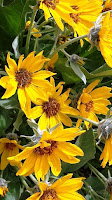
Balsamroot
The route up to the summit isn't overly difficult or long; I'd rate it as moderate. The elevation gain is steady with minimal switchbacks - a blessed relief from our past few hikes. The weather forecast for Seattle called for rain showers, but on the eastern side of the range we had partly sunny skies. It was perfect hiking weather, and the summit was calling me.
Scarlet Gillia or 'Skyrocket'
The wildflowers were in bloom; we strolled through the bursts of color provided by Starry Solomons Seal, Columbine, Paintbrush, Lupine, Balsamroot and Scarlet Gillia, to name just the most prominent performers. Their yellow, white, crimson, blue and purple colors really popped against the browns of the rocks and soil.  The wild roses and serviceberry blossoms were fragrant and their perfume mingled with the aroma of the lodgepole pine, treating our noses to a delightful symphony of scents. I was in a sensory heaven!

The trail wound around and came to a junction with the second half of our adventure, the Teanaway Ridge trail. Up to now we had been following the Iron Bear trail, which continues along the ridge. Our journey today, however, was to the summit that awaited us at the end of Teanaway Ridge, so we made a hard right and resumed our upward trek.


As we climbed higher along the ridge, the scenery changed. The trees thinned out, giving way instead to low-growing shrubs. The shapes and colors of the rolling hills and ridges, with their patchwork of forests, clearcuts and farmland unfolded around us like a quilt. The clouds in the sky would blow in on the breeze, then clear, then move in again, building on themselves in layers.


By the time we reached the summit, the winds had picked up in earnest, and the clouds had moved in, seemingly to stay. We pulled our warm layers out of our packs and ate lunch while enjoying the views of Mount Stuart and the Stuart and Wenatchee Ranges. We stayed until we started getting cold, then began our journey back down the trail.
Our group at the summit
(clockwise: Josef, Tony, Lisa, Bill, Holly, Me & Andrea)

When we reached the junction with the Iron Bear trail, we stopped for a quick break. The sun had returned, so we were able to warm up and remove layers. With the ridge somewhat protecting us from the winds, I unpacked my little trail stove and Holly unpacked the fixings for s'mores! To the amusement of the other hikers on the trail, we roasted marshmallows over the flame of my stove and indulged ourselves in a special trailside treat. We have been hiking increasingly difficult trails for the past five months, so I felt we deserved a reward in the form of a little guilty pleasure.

Once we reached the trailhead, I was able to look back on the hike and smile. Everyone did great. The good weather held for us. This trail was less difficult than the last few we had done, and our bodies seemed to appreciate the breather. My own body performed well, assuaging some of my doubt and wavering confidence from last week. Iron Bear will always be one of my favorite trails.  


Hike 27:52
Distance: 6.5 miles
Elevation gain: 1900'
Max Elevation Achieved: 5,063'


Monday, June 13, 2016

Beckler Peak

June 4, 2016


Near the summit of Steven's Pass, just outside the small town of Skykomish, stands Beckler Peak, a 5,000 foot tall hunk of white granite and quartz. The summit is reached via the Jennifer Dunn Trail, which was opened in 2011. I hiked this trail for the first time with my sister last year, and the view from the summit was astounding. I have excitedly waited for it to come up on this year's schedule so I could return.

The trail itself isn't difficult if you are in reasonable condition. It starts out on an old logging road, which is slowly being repossessed by the surrounding vegetation. From there it climbs steadily upward, taking you through a young forest to a beautiful old-growth forest. Along the way you are treated to incredible views of the surrounding peaks. When you reach an awesome set of rock steps, you are close to a view that will likely take your breath away. From here you can gaze across the recently created Wild Sky Wilderness area to Glacier Peak. We stopped here for a few moments to take it all in, then proceeded the last half mile to the summit. 

Once at the summit, the wow factor hits you full force. You are surrounded by the Monte Cristo range, Johnson Ridge, Mounts Index and Baring (as well as others too numerous to name here), Glacier Peak and, off in the distance, Mount Baker. For our trip, we were blessed with sunshine and mostly clear skies, making for even nicer views - we could almost see forever. We ate a quick lunch at the summit - partly because the sun was scorching us, and partly because it's a small patch of real estate and almost 2 dozen hikers, some with dogs, joined us up there. For safety's sake, we gave up our spots and headed back down. 
Photos just can't do the view justice... (photo by Holly Scheyer)
Andrea, Holly, Me, Zillah, Tony
The trip itself was very enjoyable. My body's performance, however, was disappointing and frustrating. I found myself plagued by the old issues of pain in my right knee, hip & hip flexor. I started out feeling drained and continued up the trail exhausted. After 18 months of hiking pretty much every weekend, I would expect to be building lean, strong muscles. Instead, my body is storing increasing amounts of fat (yuck!) and seemingly growing weaker. How can I possibly expect to make another successful summit of Mt St Helens? I am reviewing my diet and mid-week conditioning to see where I can make changes. I have too many adventures ahead to let my body get in the way.

Zillah & I - Beckler Peak Summit
Hike 26:52 Half way through my challenge!!
Distance: 7.4 miles
Elevation gain: 2,263'
Max Elevation Achieved: 5,063'

Thursday, June 2, 2016

Goat Lake Revisited

May 30, 2016

Some trails are just worth visiting more than once.
When I was making up my hiking schedule for the year, two of my co-workers learned I planned on hiking to Goat Lake. Both wanted to go, but neither was available when I had it scheduled. Thus, when I hiked to Goat Lake two weeks ago, I knew I'd be returning. What a difference two weeks can make.

The weather for my return trip was gorgeous. The morning sun filtered through the leaves of the boughs overhead, casting everything in a beautiful glow. The air was alive with the melodies of a half dozen different songbird varieties. With each step I took I could feel my soul renewing itself and a calm washed over me. I love hiking up mountains, but there is just something soothing about walking through the forest that touches the deepest chambers of my soul.

What a difference two weeks can make. I was surprised by the difference in the flow of the trailside waterfalls. The columbine was still in bloom, but most of the other springtime blossoms had faded. We proceeded past now familiar landmarks, making our way towards the lake. The vibrant greens of new spring growth had subdued ever-so-slightly to the green of summer.

As we made the final ascent up towards the lake, I could feel my excitement build in anticipation of the view I hoped was awaiting us. I quietly chuckled knowing that it was very likely someone was sitting on the wooden vault toilet looking down on us as they pooped. Using the toilet in a backcountry camp is an experience, and whoever positioned this one had an odd sense of humor. Upwards we climbed, the roar of Elliott Creek's tumble downward growing louder the nearer we drew. We finally rounded the last bend and there were the falls - the precursor that signalled we were a few hundred yards from our destination.

What a difference two weeks can make. When we first visited Goat Lake the skies were gray and cloudy. There was a strong breeze that rippled across the water's surface. Rain fell. Today the lake was dazzling and resplendent. The sky was blue with occasional clouds crossing over. The breeze was slight. The lake surface gleamed, reflecting back the image of Cadet & Bedal Peaks. It was so beautiful it actually stopped me in my tracks.
Cadet Peak reflected in the surface of Goat Lake
We made our way part way around the lake to a nice vantage point with a log on which to sit and enjoy our lunch. One of the guys treated me to a small bottle of white Zinfandel wine, which nicely complimented my smoked salmon and seemed the perfect way to celebrate such a perfect day.

 
After lunch we sat a bit longer, reveling in the beauty that lay before us. We watched water skippers on the lake's surface; at one point small trout jumped. A chipmunk scampered about looking for dropped goodies. Heaven. I hated to leave, but knew I had a long drive home and needed to be at work the next day. 

What a difference two weeks can make. Even though I had just hiked to the summit of Mount Townsend two days before, my legs felt strong. On our initial visit we had taken the upper trail one direction and the lower on the return, and I struggled. This trip we kept to the less rugged upper trail both ways. My fibular pain didn't surface until we were 2/3 of the way down. My knees, quads and hip flexors still felt steady when we arrived at the car. At trip's end I felt energized, rather than exhausted, likely still fueled by the incredible views.

What a difference two weeks can make. Some trails are just worth visiting more than once, and I'll certainly visit this one again; probably as an overnighter.

Hike 25:52
Distance: 10.4 miles
Elevation Gain: 1400'