Tuesday, November 22, 2016

Lake Sylvia

November 6, 2016


When looking for a pretty, low-land hike for autumn, don't discount Lake Sylvia State Park. This is the second time I've visited the park, the first being via kayak a few Thanksgivings ago. There is a trail that wraps around the lake, hugging the shoreline and offering water views, autumn colors, and, if you're lucky, some waterfowl taking a break on their journey south.


My cousin's granddaughter wanted my sister to shoot her senior portraits, and the venue chosen was Lake Sylvia. I tagged along as my sister's assistant, looking forward to spending time with family and hiking the loop trail. The forecast was calling for mostly cloudy which, as any true Northwestern resident knows, could mean just about anything goes. Nevertheless, we threw on our jackets, grabbed Heidi's photo gear and headed outside. We hit a rain squall on the way, but the weather broke and looked promising by the time everyone arrived, so off we headed.


Not in a big hurry, we followed the trail at a more leisurely pace, which was nice. There are benches placed along the trail where visitors can sit to enjoy the serenity, soak in the colors or do a little bird-watching. We took pause at a few where the setting & lighting was perfect for portrait shots. The colors, though waning, were remarkable, matched in beauty only by the subject of the portraits. I carried a deflector shield with me and had fun bouncing light off things as we walked. The rain-swollen lake spilled over its banks, flooding a few hundred feet of trail with 6 inches or so of water. Our family isn't easily dissuaded, so we rolled up our pant legs and splashed our way through. Our feet may have been soaked, but we were having fun!

As the trail wrapped around the end of the lake, we encountered our only elevation gain - the trail quickly climbed about 3 stories. Just before dropping again and delivering us back to the lakeshore, we were treated to an adorable covered bridge spanning a small stream. Heidi shot a series of photos here, giving the rest of us time to more thoroughly appreciate the beauty of our surroundings. Autumn yellows, golds and browns blended with the darkness of the evergreens, standing in contrast to the deep blue of the lake. As I leaned against the railing, gazing out through the trees,  a small flock of Canadian Geese broke the glassy surface of the water as they swam past. Above us, birds chittered and flitted about. Below us a plethora of fungi grew profusely. It was enchanting.


Another stop was made at a picturesque location on the bank of the lake where a few more shots were taken, then we finished our day back at our cars.


I always enjoy watching my sister work, especially when it means time can be shared on the trail. We were blessed with good weather on a weekend with a stormy forecast, and the opportunity to spend time with family ... and Lake Sylvia was the perfect host.


Challenge Hike 52 of 52.
Distance: 5 miles
Elevation gain: 30'
Max Elevation Achieved: 170'


Friday, November 11, 2016

Iron Goat Trail

October 30, 2016


Tunnels of Terror. Who can resist a trail with a history that includes that phrase? Certainly not me!


The Iron Goat Trail was so named as it was once part of the Great Northern railway over Stevens Pass - and their logo was the mountain goat. This section of rail was considered, at the time of its construction in 1893, the best engineered of the transcontinental railroads. Seattle had just celebrated its 40th birthday, and was now connected to the Midwest by rail, providing a faster method to transport its main export - lumber. Trains struggled over the steep route, which required locomotives at each end of the train to climb the grade and negotiate the sharp turns. During the winters, snow 25 feet deep would immobilize the trains for days while dozens of laborers wielding shovels dug them out. In 1900 a 2.6 mile long tunnel was completed, as well as a series of snowsheds which somewhat helped. However, in March of 1910, a huge avalanche of heavy, wet snow came barreling down the mountainside. Two trains were waiting outside the small community of Wellington for the tracks to be cleared of snow and were swept up by the avalanche. All 97 people aboard were killed; the snows were so heavy that year that the last body wasn't recovered until July. The costs of constant maintenance and downtime of the trains was insurmountable - Great Northern finally gave up and built a 7.8 mile tunnel beneath Stevens Pass, which is still used today. In 1929, just 36 years after it was built, the old tracks were abandoned.


Work began in the 80's to restore the grade, and construction of a trail began in 1992. Built primarily by volunteers working weekends, it wasn't completed until 2007. The Iron Goat Trail is well built and well maintained, with many sections ADA accessible. All along the way there are the old tunnels and the concrete support walls of the snowsheds, the wood structures of which having long ago collapsed and/or been removed. There are interpretive signs placed along the route pointing out historical facts and natural points of interest. It has long been on my bucket list and, knowing its tragic history, I thought Halloween weekend was as good a time as any to hike it. My sister Heidi, and friends Andrea and Annelise (also sisters) joined me.


Timber Spillway
It was raining the day we chose to hike the Iron Goat Trail, which added to the ominous air of the route. As we hiked along the wide, mostly flat trail through the forest, we could hear the sounds of nearby trains making their journey across the pass. The fact we couldn't see them, only heard their sounds echo off the walls of the nearby ridges and peaks, made them seem like ghosts. It was hauntingly eerie. Ground water gushed over the edges of the snowshed walls, creating waterfalls.  That lumber of a spillway remains, with water freely flowing over it, fueling the decay that will someday devour it. Back in 1893, this spillway was the  pride of the railway, which was part of their firefighting system.The tunnels are collapsing and entering them is dangerous. Should you dare to venture in a few yards, however, you are immediately surrounded by absolute silence. From time to time we would encounter large pieces of steel left behind, their previous function a mystery.

Steep section of trail to the upper trail
There are three trailheads to access the Iron Goat Trail and multiple choices of route, which means you can choose the length and difficulty of your hike. We started at the Martin Creek trailhead and hiked to the trailhead at the other end (where there is a potty). From there we took the Corea Crossover, named for the small railway community that was once located here. This crossover led us via a steep climb to the upper trail. It was hard to imagine a train having to chug up that same 700' incline. Granted, they had steam and I only had two skinny legs, but I weigh a whole lot less. Under either scenario it was still a grunting ascent. From there we continued on a spur trail to Windy Point. We were buffeted by driving rain and gusts of wind. The valley below us was filled with misty clouds. Somewhere down there we could hear the sounds of another distant train travelling unseen. As it passed, its sound was replaced by that of a large waterfall that could be seen on the opposite side of the pass. We were at risk of losing daylight on our return, so we didn't travel the 3 additional miles out to Wellington and the site of the disaster. We'll save that visit for another trip.


Danger still exists along this long-abandoned railway. A few years ago a 15-ft tall avalanche let loose, demolishing a bridge and burying a large portion of trail. Had anyone been on the trail (which isn't advised after snows begin falling), their souls would have joined the 97 that still haunt the area.


Hike 51 of 52
Distance: 6 miles
Elevation gain: 700'
Max elevation achieved: 2,800ft

 
Rugged Gnarly Women; Me, Heidi, Andrea & Annelise

Monday, November 7, 2016

Fort Casey / Admiralty Head Lighthouse

October 29, 2016


Anyone who grew up in Western Washington during the 60's and 70's likely has fond memories of visiting Fort Casey in the sixth grade. We would packed our suitcases and headed to the enlisted barracks, now called Camp Casey, for an overnight field trip as part of our Washington History course of study.

Fort Casey, along with its siblings, Forts Flagler & Warden, has great historical significance in the Pacific Northwest. They were shortly built after the Spanish-American War to protect Admiralty Inlet, and subsequently Puget Sound, from attack or invasion by sea. They were armed with 10-inch guns on disappearing carriages, which would raise from their protective emplacements long enough to fire, then recoil back down out of sight. However, by the time construction was complete, the forts were obsolete due to the introduction of aircraft to the military arsenal. Fort Casey was utilized as a training facility in WWI and WWII, decommissioned in the 1950's, and sold to Seattle Pacific University. The forts are a wonder to visit. I have returned dozens of times in the years since sixth grade to explore and marvel. No matter how many times I visit, or how old I get, Fort Casey still brings out the little girl in me.


Most people just visit the fort batteries where the guns reside. Many also walk up the hill to visit (and maybe tour) the Admiralty Head Lighthouse. Few, however, venture to follow the trail down to the old storage bunkers, which are built into the hillside. Even fewer wander down the hill to the beach, from where you can view the platforms that once housed big searchlights. Although more of a stroll than a hike, if you plan your adventure right, you can link everything together in a big loop that includes woods, nature (deer) and pretty sights. 


This particular Halloween weekend my sister was part of a group who were haunting the fort. I was in the mood for a good scare and couldn't think of a better reason to re-visit one of my favorite haunts. My co-worker, Corinne, and her friend Tim had never been to the fort, so they joined me for this Halloween adventure. I bundled up for the weather and started my adventure aboard a ferry bound for Whidbey Island. 


I met up with my sister, Corinne & Tim in Coupeville where we had lunch. We wandered the small shops along the waterfront, taking in the historical buildings and marvelous smells wafting from the doorways of the small eateries. These aromas mixed with the sea air for an olfactory treat that can only be described as heavenly. From there it was a short drive to the Fort Casey State Park. We left from the lower parking lot and walked up the grassy knoll to the lighthouse.


The Admiralty Head Lighthouse was originally built in 1856, moved in 1897 and replaced. The current lighthouse has stood in its this location since 1901. With ships' power moving from air to steam, the marine traffic lane shifted more to the western slopes of the inlet. Thus, just 19 years into her service, the Admiralty Head Lighthouse was extinguished. At the time of its construction, it was considered one-of-a-kind as it was of stucco construction and 'fully modernized' housing both an indoor bathroom and laundry room. It's sturdy construction has helped it survive the forces of nature for over a century. It is lovingly preserved, maintained and cared for by a volunteer force of 'friends'. These volunteers keep it open for visitors to tour, and are always happy to answer questions about the lighthouse and its neighbor, Fort Casey. Unfortunately, due to the Halloween event being held at the fort, they had closed the doors of the lighthouse early. I was disappointed that Corinne and Tim weren't able to climb the tower and gaze out the windows of the Fresnel housing across the inlet and into the Straight of Juan de Fuca.


The next leg of our adventure was the fort and its guns. We headed back down the hill to the cement walls of the fort, climbing the stairs up to the emplacements. We ran our hands along the walls, the ammo carriers and the guns themselves. The fort may be a sight to see, but you can actually feel the history under your fingers if you take the time. The craftsmanship that went into pouring the walls and mounting the heavy iron & steel hardware can best be appreciated by both looking and feeling. We wandered the length of the structure, exploring rooms and lookout towers as we went, then followed the route taken by the soldiers to the storage bunkers. We entered two of the bunkers, walking from end-to-end in total darkness. Our footsteps echoed against the cement walls, fueling the eeriness. I was thrilled that a compartment was open that hasn't been in my past visits ... we were standing in one of the enlisted waterclosets (toilet). On the floor were the remaining signs of the two commodes that once stood there, as well as a urinal on the wall. There was no sink for handwashing. Privacy was afforded by wood partitions, the hand-crafted outer framework of which remained, worn smooth and stained a dark brown by time, water, and visitors' hands. Tim walked into one of the guardhouses, which looked upon both the bunkers and out over 'Crocket's Lake'. If I'm correct, this shallow body of water is where the ferry from Port Townsend now docks. 
Taking aim along one of the 10-inch guns
 
View from one of the Lookouts


We continued on our journey, winding back around and up the hill, returning to the Lighthouse. The sun was beginning to set. I took the opportunity to shoot a photo, then we headed back down to the fort to partake in the 'Haunted Fort' event.


After playing some kid's games, eating some awesome cotton candy and having the bejeebees scared out of ourselves in the fort, it was time to call it a day. The volunteers did a fabulous job haunting the facility and I look forward to returning. As we crossed the field some very ominous and creepy music was being broadcast. We looked up to see a line of cars proceeding slowly down the hill ...


Well played, Fort Casey. You transported me back to sixth grade and left an everlasting impression on me yet again.


Hike 50 of 52.
Distance: 3.5 miles
Elevation Gain: 150'
Highest Elevation achieved: 200'


Friday, October 28, 2016

Lester Ghost Town

October 22, 2016


I love fall. I enjoy watching the leaves change colors and float to the ground. I love the change in lighting as we rotate away from the sun. I'm a kid at heart, so love splashing in the puddles and jumping on leaves. I love the chill in the air, foggy mornings and the aroma of baking that begins with fall. I love autumn not only because of these reasons, but because, frankly, I love the fun of Halloween. It seemed only natural for me to hold out a trip to the ghost town of Lester until October.

Historical photo (c.1984) showing Guard's house & Warehouse
A little history on the town of Lester. It started out a logging camp back in the 1800's. When Northern Pacific Railroad laid tracks over Stampede Pass, the little community tucked away in the woods was the perfect location to re-supply their steam locomotives. They would fill up with water from the nearby river and coal before the long haul up the pass. Eventually a depot went in, as well as a roundhouse, coal dock... and, in 1892, the town of Lester was born. With the transition to diesel locomotives the town began dying. In 1962 the City of Tacoma began buying property in an effort to protect its Green River Watershed. In 1984 the Stampede Pass line was mothballed - the final nail in Lester's coffin. Tacoma purchased the majority of the remaining property, leaving just one resident in town. Gertrude had been the school teacher and truly loved Lester. She continued to live there until her home burned down in 1993, but Lester was her true home and she revisited often until her death in 2002, at the age of 99.


There are a few buildings still standing in Lester, and they were our destination for the day. It had rained all week, but the day dawned bright - a good day to visit Lester and perhaps encounter Gertrude's spirit. The Poplar trees were a vibrant yellow, in stark contrast to their evergreen neighbors and the blue of the autumn sky. We bumped and swerved our way 13 miles down a twisty forest road, enjoying the changing view with each turn, until we arrived at the gate that signified the end of the road - and the beginning of the trail.


The 'trail' follows an old roadbed to the town. It is still utilized by the City of Tacoma and Burlington Northern Railroad, so is wide and well maintained. It was a nice change from the rough trails I've traversed this past year. The Green River quietly wandered alongside us for a portion of the way, lending itself to the beauty of the landscape. We were able to let the dogs off-leash, and they enjoyed the freedom to romp and sniff. Buster and Cupcake were last minute additions to the trip and they enthusiastically ran up ahead, each making the adventure their own.


After a nice leisurely 3.5 mile walk, we arrived at the town of Lester ... or rather, what little remains. The only structures still standing are the guard's house, one other home and a shed. The old warehouse has caved in under the weight of winter snows and time, and isn't rapidly being reduced to a pile of lumber. We adventured around, looking for foundations of other structures, relics and artifacts. The two houses are still surprisingly structurally sound, so the grandkids and I poked around inside them. Buster was really hoping to encounter a ghost or two, but wasn't disappointed at not finding any. Entering the homes was like stepping through a portal back in time. The kids stayed close as instructed and touched nothing but investigated everything. I explained what things where and how life was lived 'back in the day'. They hung on every word, asked questions and soaked it all up like sponges.

Looking out at the hillside from the guard house


What remains of the Warehouse
 
Mist rising from the Ruins (warehouse)


Awesome Sofa Frame on Porch


My little ghost busters

Autumn sun rising over old residence


From the buildings we wandered out into the woods, which are edging ever closer to swallowing up all evidence of the town. Buster went off a wee bit on his own, searching for ghosts or zombies, always staying within line-of-sight (Nana has trained him well). Cupcake and I shook trees to make them rain on each other, climbed over logs and generally just enjoyed each other's company. While out there we came across two old washers, one with the wringer apparatus still attached. There were parts to a car or two strewn about, and a smaller wood cooking stove. However, beyond these nifty relics, we found no further testimony to the residents who once lived here.
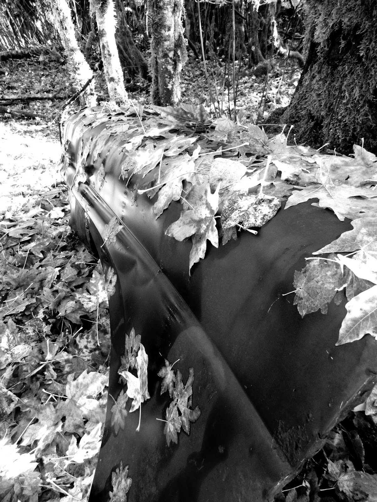
Old Quarter Panel covered in Leaves

Washing Machine Wringer

Add caption


We started walking back out of the woods as a train came rolling to a stop in front of the guards house. It lent an eerie feel to our adventure as we thought back to the life that once bustled here, centered around the arrival of the trains. We watched as the train resumed its journey and pulled away, then crossed the tracks to explore the meadow. I had hoped to find some building foundations, but what we found totally made Buster's day. There, hidden in the tall grass, was the skeletal remains of an elk.


It came time for us to think about our return trip home. We walked down the tracks until we came to a cement culvert over a stream. We sat here, dangling our legs over the edge and had lunch while admiring the awesome colors that blanketed the surrounding hills. Buster announced that autumn was his favorite time of year. I think I would have to agree with him.

While we sat, we talked about our day's adventure. We discussed plans for future outings, including a return to Lester for another day of exploration. I love autumn days, and this one will go down as one of my favorites.


Hike 49 of 52.
Distance: 7.5 miles
Elevation gained: 300'
Highest Elevation Achieved: 1640'


Tuesday, October 11, 2016

Tunnel Creek

October 8, 2016
Tunnel Creek trail has long been on my bucket list of trails to hike - I just didn't think it would be this year. We originally headed out to explore a different trail that would connect us with one we had hiked earlier in the year. However, after spending 45 minutes driving all over the forest on service roads following crappy directions, (even Siri got lost) I threw in the towel and headed for the well-signed Tunnel Creek trailhead. The WTA (Washington Trails Association) had a trail maintenance crew out there, so I figured we'd be okay, since we had no trail map, no trail description, and no clue what we'd find once we stepped onto the trail. My hiking partners today were Bill, Maddy and her boyfriend Aram, and Zillah.


Tunnel Creek is 8 miles in length and has two trailheads, one at the north end of the trail and a considerably more difficult one at the south end of the trail. It is located outside Quilcene, in the northeast corner of the Olympics. It was named Tunnel Creek due to the habit the creek has of disappearing during the dry season. Since I hadn't researched or prepared for this hike, I wasn't entirely sure which trailhead the signs were directing us to. I sighed with relief when we arrived and learned that we were at the north end. We stopped at the trail info board, determined our destination, signed in and headed on our adventure.
Foggy morning on the trail


The Tunnel Creek Trail starts out moderately uphill, then steepens to about a 20% grade. It was lightly raining as we hiked through low-lying clouds. The golden hue of the changing maples brightened an otherwise grey day. Our steps were quieted by the soft tread of a trail covered in needles, wet leaves and small hemlock cones. There were a couple trees down across the trail that we navigated without difficulty. They looked recent, as there wasn't evidence of much foot-traffic detouring around. The air was crisp and smelled of loam; I breathed in as deeply as my ribs would allow and slowly exhaled. Autumn was officially upon us and I was in heaven.

As we climbed, I found myself laboring up the trail. Again. Instead of growing frustrated and getting discouraged, I reminded myself that I am still healing. Recovery was going to be slow and I just had to let my body take its time. Zillah was content to trot up and down the trail, keeping all members of our group within her sight. We were maintaining a good, steady pace and, before we knew it, we had reached our 2.5 mile mark. It was at this point that we pulled off the trail to sit on the bank of Tunnel Creek and have a bite to eat. Here the creek cascaded over boulders on its way downhill on its way to meet up with, I believe, the Quilcene River. The forest was quiet, with no sound beyond that of the tumbling waters and our own conversation. I don't think we could have found a prettier spot in all the woods.
Tunnel Creek
After a quick lunch, we headed back towards the trailhead. It had been our intention when we started out to make this day a short day, with 5-6 miles as our goal. On our way down the trail, we encountered the WTA work crew, who were busying themselves with the task of removing the downed trees. We are very fortunate in this state to have some great volunteer organizations who build and maintain our many trails. We greeted them and thanked them for their hard work, the results of which were obvious. When once again we arrived at the trailhead, we signed ourselves back off the trail and peeled off our wet gear.

I look forward to returning to this trail to hike in its entirety next year. I learned that, roughly 1/4 mile from where we stopped, a surviving shelter still stands. The Olympic shelters hold a special spot in my heart, so I am already planning my visit. As advised by my doctors, I will keep my hikes on the shorter/easier side as I continue to mend from my fall. Fortunately, autumn is the perfect time of year for lighter hikes...

Hike 48 of 52.
Distance: 5 miles
Elevation gain: 1500'
Highest point: 3620'

Thursday, October 6, 2016

Slab Camp Creek / Upper Gray Wolf River

September 18, 2016


I love hiking in the Buckhorn Wilderness. Located in the northeast corner of the Olympic peninsula, it has a lot to offer hikers of all abilities. I never grow tired of exploring the trails there. The Gray Wolf River trail was once 18 miles in distance, until a flood in the 1990's washed out the bridge that spanned a high, narrow canyon. The trail has subsequently been cut in half and the upper portion has almost faded into obscurity. The Lower Gray Wolf River trail is moderately hiked, and absolutely gorgeous. I, myself, have hiked to its abrupt end twice. I have stood on the canyon wall nearby the previous location of the bridge footings, gazing across and trying to pick up the trail on the other side with my eyes.

I'm still mending a cracked rib from a recent fall so wanted to hike a trail that would push me a little but not too much. The Slab Camp Creek trail fit the bill perfectly. It was also a good opportunity for my co-worker Alyson to hit the trail with me, and to provide Zillah with a much needed romp. Hiking partner Evie and her granddog, Jax, joined us as well. With a glorious sunrise drive north along the Hood Canal and a weather forecast in our favor, it was shaping up to be a fantastic day. I can't think of a more glorious way to while away the time than walking through the forest with friends.  

Dense forest surrounded the trail

If you are seeking solitude, then this is the trail for you. In fact, you may be the only people in the forest, as were we. The only other car at the trailhead was out on another trail with the same terminus. Once we located our trail, we set off on our adventure. The trail quietly and steadily marches you downhill into a beautiful and deeply forested canyon. The forest here was so dense that I'm sure it coined the phrase "You can't see the forest for all the trees". The understory was thick with salal, devils club and ferns. A thick carpet of moss covered the forest floor. The air smelled of nourishing peat and bore the wet, mossy perfume of a forest preparing itself for winter. I couldn't help but stop and draw a deep breath. I could almost feel my blood pressure lower a few points as I exhaled. Peace.
 

Alyson travels down into the canyon
Once on the canyon floor, we crossed a few streams then regained a bit of our elevation. As we came to a junction, we turned left onto a trail less travelled while the main trail headed west towards Deer Park, which lay beyond the National Park boundary. We were now on the upper  portion of the Gray Wolf River trail, which hugged the wall and carried us back down into the canyon. Here the Gray Wolf River thunders through a narrow gorge, carving into the canyon wall with the force of its waters. Zillah stayed right at my heel as we worked our way down the trail. We pushed through brush where it grew over the trail. We had to navigate a washout and uprooted tree. In places the trail was so scant it was nothing more than a boot path. The river below us filled the forest with its modest voice. Later in the year, when the water level has risen, his voice will be more resounding.


Once on the canyon floor we witnessed the river's force and determined resistance. Where the canyon had closed in, constricting the river into an anorexic channel, it had undercut the canyon wall and carved itself a massive overhang. The colors of the river were amazing, ranging from dark grey to turquoise. We wandered along, not far from its banks, for a short while before the trail started to climb again, towards its terminus - the location of the former bridge. The end of the line for us, however, was a landslide that took a sizeable portion of trail with it. I looked up and across, my eyes scanning for the trail on the other side. Once I picked it out, I was satisfied as my quest had been fulfilled.


Our trip back to the trailhead was serenely quiet and peaceful. A storm was brewing; not only could we feel it, but the birds could as well. They were all tucked away under cover in their nests. A brave chipmunk scampered across the trail and up a tree, enticing the dogs to a quick game of chase. Both were quickly called off the 'hunt' and obediently returned to our sides. Evie's hamstring injury flared up with about 2 miles left to go until we reached the trailhead. An occasional drop of rain hit our heads, which motivated us to continue on. I have to commend Evie on her ability to hike through the pain and maintain her pace up the trail.

The skies continued to darken, so we quickly loaded the dogs and packs into the car in an effort to beat the impending storm. Just as we engaged the transmission to 'Drive', the skies let loose. The rain that fell came down in buckets - enough so that we had to stop the car because the wipers couldn't keep up. Seemingly out of nowhere, a half dozen deer appeared in front of us, racing into the dense tree cover we had just left. The squall passed quickly enough and we proceeded down the road, which was now channeled with streamlets of ground water. We praised our good fortune and the many blessings of the day as we returned to civilization. I feel doubly blessed that I am able to experience these adventures with such wonderful friends and Zillah at my side.

Ever-vigilant Zillah
Hike 47:52
Distance: 7 miles
Elevation gain: 1100'
Highest point: 2540'


Tuesday, September 20, 2016

Tolmie Peak

September 11, 2016


My sweet mother, whom everybody loved, has been gone from this earth for over 25 years. She was a kind, loving and generous woman who truly loved fishing, farming, and the outdoors - values she instilled in her daughters. Today would have been her 85th birthday. Each year my sister, Heidi, and I try to do something to commemorate the day and honor her memory. Sometimes we go together, which would have thrilled Mom, other times we celebrate the day separately. This year we chose a trail to hike together that she would have enjoyed - the trail to Tolmie Peak Lookout.


For me the adventure began on the road. The last 11 miles is all gravel and heavily washboarded, with occasional smatterings of potholes thrown in for good measure. My rear-wheel drive Mustang with sport suspension isn't exactly the best vehicle for such roads ... unless you enjoy the excitement of fish-tailing, and glissading uncontrollably across the surface, then eating the leather wrapped steering wheel as you hit an unseen pothole. I was attempting to apply ChapStick to my lips as I hit one particularly rough section. Had I been applying lipstick, the result would have looked like I was a victim in a low budget slasher movie. The mental image had me laughing the remainder of the drive to the trailhead.   
  
Tolmie Peak a popular trail located on the northwest side of Mount Rainier. The trailhead shares parking with Spray Park and Mowich Lake, which are also very popular, so it was good that we arrived early. By the time we came off the trail, the cars lined the road as far as I could see in both directions. We packed our last minute items into our packs, made some final adjustments and set off down the trail.

Just a few dozen yards down the trail I got my first peek at Mowich Lake. I had visited here a few years prior but under very different circumstances, and I remember very little of the lake. The trail descriptions don't prepare you for the wow factor. The sun had burned through the fog and was glistening off the lake's surface, a myriad of tiny prisms dancing in the light. Snow still covered the taller peaks behind the lake and the air had that feel of autumn. I took a few minutes to enjoy the view while chatting with some Sierra Club members who were performing trail maintenance on that section of the trail. Meanwhile my sister jogged back up to her car for a backup camera battery. It's always good to be prepared - especially when you're a photographer. 

We continued down the trail through a pretty forest, descending the majority of the way. The further down the trail we proceeded, the denser the forest grew. Eventually we started climbing and came to a junction that gave us the choice of Eunice Lake/Tolmie Peak, or Ipsut Pass. Neither of us had ever been to Ipsut Pass and it was only 1/4 mile up the trail, so we decided to take a quick detour. We popped around what looked like a large boulder (but tuned out to be a chunk of mountain) and were stopped in our tracks. Again, wow. The terrain dropped away from us quickly, the trail hugging the cliff wall to our left as it wended its way down into an absolutely gorgeous valley. Everything below was a beautiful emerald green. The clouds were beginning to move in, with swirling wisps wrapping themselves in and around the trees. It was breathtaking. We stood there at the top of the pass and drank in as much beauty as we could, then started back down to the junction to resume our journey. 


Breathtaking Ipsut Pass


Before long we had climbed out of the lowland forest and into a sub-alpine forest where the trees grow shorter and less densely. Between the clusters of trees were alpine meadows, just beginning to cloak themselves in their autumn colors. The brown-gray cliff face and ridgeline of Tolmie Peak jutted up imposingly in front of us; our destination, the old fire lookout, standing sentry at the top. And, sitting as a centerpiece to all of this, was the deep blue surface of Eunice Lake. We wandered along the shoreline, enjoying the serenity she exudes. Mom would have loved it here. She would have enjoyed fishing from the shore, whether there were fish biting or not. Guaranteed, had they been biting, 'fish eye basketball' would have been the entertainment for the evening.


Eunice Lake as viewed from the lookout
Eunice Lake was but a pit stop on our day's journey. We still had a mile, with 600 feet of elevation, to go before reaching the fire lookout. Although not nearly as steep as my summer hikes have been, I found myself struggling with this last push to the top. I started to get discouraged, but reminded myself that I was still recovering from a fall down a mountain. At least, that's my story and I'm sticking to it. The clouds continued to move in as we climbed, pretty much ensuring we would not be getting the 'in your face' view of Mount Rainer that this lookout is known for. We reached the lookout with only nominal effort. Once there, we found a spot to sit where we ate lunch and celebrated Mom. Although not jaw-dropping, the view was still remarkable. The actual summit of Tolmie Peak sat to our left and was accessible via a small spur trail. Due to my recent fall, we opted not to summit today. The clouds swirled about in front of us, amazing us with their dance-like movements. It was inexplicably poetic and planted a seed for future writing.
Tolmie Peak Summit
Our return trip down the mountain went quickly and without incident. We skillfully navigated the road and stopped to share a dinner together before parting ways. Our mom had two girls who bickered and fought through the majority of their childhood. It would have thrilled her to see us together as friends. It would have benn, I think, her birthday wish.


In loving memory of Patricia Pfeifer.

Heidi on the shore of Eunice Lake
Hike 46 of 52.
Distance: 7.5 miles
Elevation gain: 1100'
Highest elevation achieved: 5,900 ft