Tuesday, May 31, 2016

Mount Townsend

May 28, 2016

Our original plan for the day had been to hike out to an alpine lake on Stevens Pass. The trail, however, is still snowbound. Our alternate has some trail damage and the ranger district is closing it for repairs. Needing a trail that would give us comparable distance and gain for our conditioning, I chose Mount Townsend. I've hiked to the summit a few times in the past, so knew it would fit the bill. It would also give me an opportunity to check the progress of my own conditioning.


Mount Townsend is found in the northeast corner of the Olympics. Her summit sits 6,260 feet above sea level. The sweeping views from the top are magnificent on a clear day. You can see from Port Angeles to Seattle, and north to the San Juans and Canada.

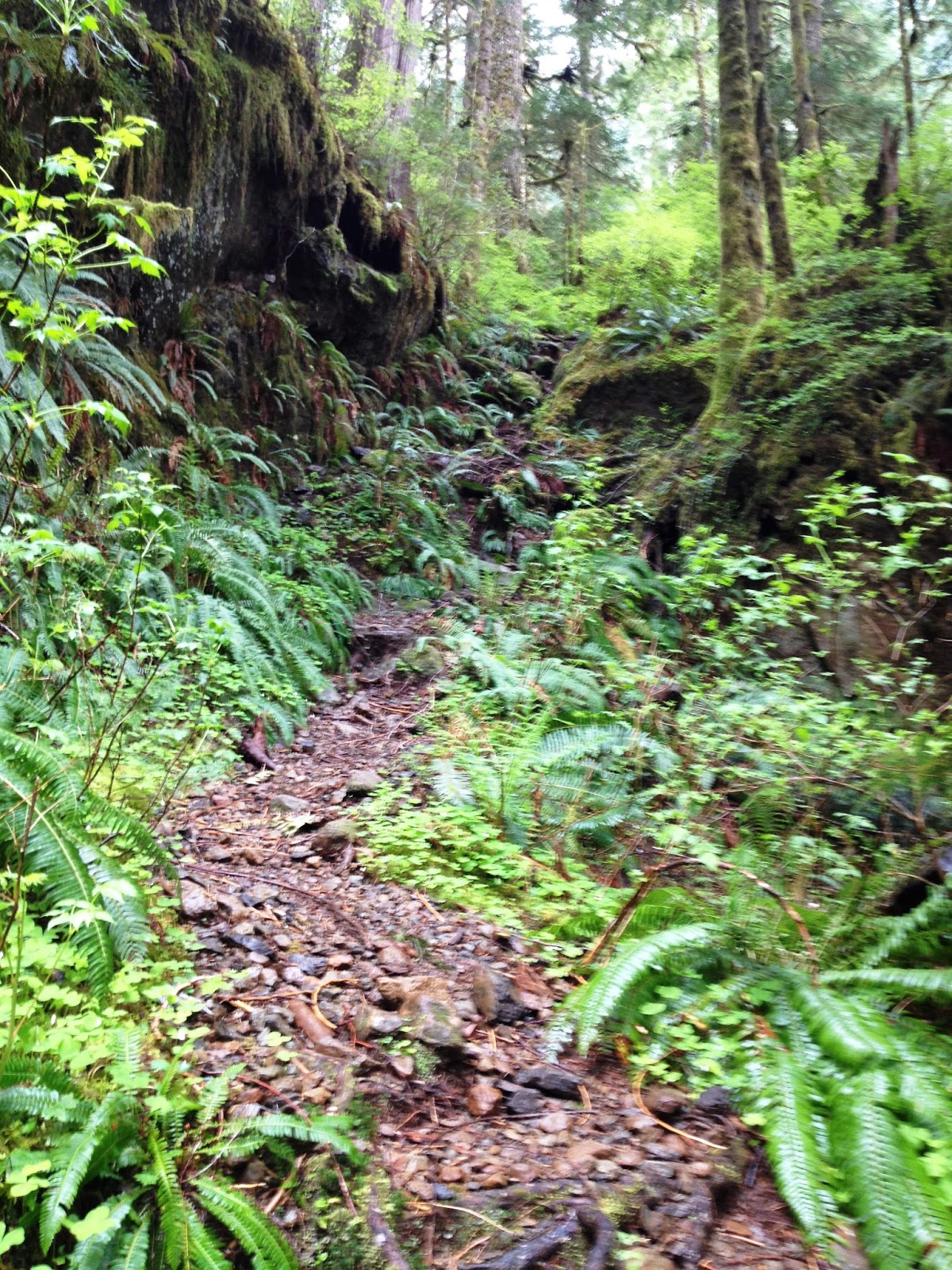
The trail to the summit is very straight forward - it begins in a lush, green forest, then ascends at a steady and continuous rate up the mountain via a well laid out set of switchbacks. The trail carries you up out of the forest to where the subalpine fir and juniper line the trail. All along the route you are treated to views of the peaks and ridges of the Quilcene area as well as Hood Canal and Puget Sound. In late spring and early summer, the wild rhododendrons and wild flowers bloom, adding their bright colors to the landscape.

Photos by Andrea Cuaron & Carol Sweeney
Our group has been conditioning hard, not only on the trails, and the results of their efforts are becoming visible. Far fewer rest breaks were needed, and our uphill pace had picked up and remained more consistent - both signs that our endurance levels are increasing as well as our stamina and strength. I noticed a marked improvement over my own performance since last year's trip, which made me happy.

As we approached the meadow area before the summit, the winds hit us. Until then we had been relatively protected by the mountain. This is my favorite area to rest and have lunch, but the buffeting winds made this difficult. I found us an area on the leeward side of a rocky outcropping where we sat amidst the snow, junipers, dwarfed trees and alpine wildflowers where we could sit protected. The temperature had dropped considerably, so we donned our warm layers and ate lunch. As we ate, we watched in amazement as the clouds would blow in then out again. The backdrop was ever-changing, leaving us intermittently sitting in the clouds or gazing upon blue skies.

Lunch in the clouds

View from the summit - Photo by Carol Sweeney
From that point, the summit is roughly half a mile away and not only visible, but seemingly close enough to touch. Although the winds continued to blow, with strong gusts that almost knocked me off my feet, we returned to the trail to finish our journey. This was our fourth summit as a group, and it felt good to achieve it together. For most of the group, this was the highest altitude they have achieved, and a good introduction to the changes we will experience as our altitudes continue to climb.

Me, Evie, Andrea, Myke (Dan taking our photo)
As always, it came time for us to begin our descent back down to our cars and home. The trip down was uneventful. I was pleased with my own body's performance, both up and down the trail, and I am finally starting to notice positive changes. I still have difficulty with the steeper portions of the trail when going down. My quads/knees don't feel as weak as they did last year, although my hip flexor still refuses to cooperate. The fibula issue that has recently troubled me didn't appear until we were almost off the trail, so I believe it is aggravated by rougher terrain. I don't think it will be an issue on Mt St Helens, but will continue to keep an eye on it.

I am so thankful I usually have a trail or two tucked in my back pocket for occasions like we had this week. I am also extremely thankful that we were gifted with 10% - the forecast for today called for a 90% chance of rain. And, I am thankful for all the glories that Mount Townsend offers us every day. She may not tower above other peaks, but she will rise tall in our memories for years to come.

Atop Mount Townsend summit
Hike 24:52
Distance: 8 miles
Elevation Gain: 3010'
Max Elevation Achieved: 6,260


Thursday, May 26, 2016

Copper Creek / Lightning Peak

May 14, 2016


There is, I believe, a hormone or something emitted by a woman's brain that allows her to forget the pain of childbirth in order that she will ensure the survival of our species by having successive children. Hikers have that same anomaly. We must. Otherwise what would drive us to return to the difficult trails? I hiked this same trail last year and voluntarily returned to hike it again this year. Not without trepidation, but returned nonetheless.


Bill makes his way up a typical
section of trail
 
The Copper Creek trail is short and to the point. It starts out steep, then gets steep, and finishes off ... well, steep. There is no huge payoff at the top; no sweeping vistas, no craggy summit. It is for this reason that many people bypass this trail for others in the area with more 'bang for the buck'. I like the trail for that precise reason - one thing for certain you'll find on this trail is solitude.

Andrea on a more civilized section of trail
The trail to Lightning Peak isn't without its benefits. Copper Creek is beautiful and unique in that it disappears into a fissure and finishes it's trip to the Skokomish River underground. Up until that point, it runs wild within the confines of a narrow canyon. The trees grow tall and the understory is lush and vibrant green. There are two small mines about 1/4 mile in, and another one 1.4 miles up the trail, all dating back to about 1915. This last one we went in search of but couldn't locate. The trail itself follows the route equipment was hauled, via mule, to the upper mine.
Tamer portion of Copper Creek
Crossing Copper Creek
In 2.5 miles we reached the summit of Lightning Peak. We had just climbed 2,000 feet of elevation and we were ready for a well-deserved break. We sat on logs amidst the clouds to eat our lunches. Our conversation died quickly as we each keened our ears to appreciate the absolute nothingness of the silence that surrounded us.


As we (slowly) made our way back down the trail we encountered three small groups of hikers headed up. I was surprised because you rarely encounter anyone else on this trail. All other life on the trail had sought shelter from the light rain and we again felt the isolation one associates with this trail.


Upon returning to the car I was able to look back more fondly on the trail. I was tired, but not exhausted. My quads & knees held up much better than they had last year. My 'new' issue in my fibulas had arisen, but not as severely as on recent longer trails. Everyone in our little group did great on this challenging hike. It has been rewarding to watch their progress and cheering their accomplishments. In time the memory of the more challenging portions of the trail will fade and when they do, you will find me hiking up to Lightning Peak again.


Our group at the Summit; Bill, me, Andrea

Hike 23 of 52.
Distance: 5 miles
Elevation Gain: 2,000'
Max Elevation Achieved: 3,200'

Wednesday, May 25, 2016

Goat Lake

May 14, 2016


Goat Lake is an alpine lake located about an hour outside Granite Falls. We needed a trail with some distance and of intermediate difficulty that would help build our endurance, and this trail fit the bill perfectly. I had seen photos of the lake that awaited us 5.3 miles up the trail, so I was looking forward to reaching our destination. I wasn't prepared, however, for the incredible journey...


We began our trip with what could likened to a stroll through a lowlands forest. The first two miles of the trail can be travelled via either an upper or lower route. We took the upper, much of which follows an old roadbed for about a mile. The trail was wide (by trail standards) and smooth for a  ways. The trees were primarily alder and maple, and thick. They stood as tall and close as soldiers protecting the wilderness that lay just beyond. Their branches were laced like clasped hands above us, their new leaves whispering in the breeze. The understory grew thick with salmonberries and ferns, with just about every local variety in attendance. There were devils club and skunk cabbage that grew larger than I can recall ever seeing. The upper trail also treated us to waterfall after waterfall, and wildflowers galore. Vivid yellow Evergreen Violets, Red Columbine, Bleeding hearts, False Solomon's Seal and Hooker's Fairybell bloomed all around us.


Some of the waterfalls along the trail

Evie demonstrates the girth of an ancient cedar
The trail carried us across a stream and there the lowland forest seamlessly transformed from one of youth to one of ancient wonder. We were walking through a primordial forest where timeless cedars stood, faithful keepers of ancient secrets. Were they so inclined they could share the region's history from before the first barefoot man wandered over their roots and under their boughs. They would tell tales of squirrels, deer and other forest denizens over whom they have towered for generations. Oh, to speak the language of trees has always been a fantasy of mine.

However easy it would be, I couldn't lose myself in dreams and imagination. Here the trail merged with the lower route and began to climb in earnest towards our destination. The majority of the elevation on this trail comes in the second half. As the trail carried us upward, the forest transformed again and we found ourselves hiking now through a climactic forest at the height of its evolution. The air came alive with the smell of silver fir and western hemlock ... and the sound of Elliott Creek. 

Elliott Creek begins its life by tumbling out of Goat Lake in a massive series of waterfalls and rapids. It is impossible to capture it all in one photo frame. In fact, I took two separate panoramic videos of the upper and mid-sections, and only caught about a quarter of it. All this beauty, and we hadn't even reached the lake yet! 


From the falls it is only a matter of minutes before you finally arrive at Goat Lake. The skies were turning gray and threatening rain when we arrived lakeside, with just enough wind to set the surface a-ripple. We climbed out on the logs at the end of the lake, where we ate lunch and relaxed in the tranquility of our surroundings. Before long we felt the first few drops of rain hit our shoulders, signaling time for our return trip.
Goat Lake


On our way back, we took the lower route. The terrain was considerably rougher and harder on the knees. The tradeoff is that it follows Elliott Creek almost the entire way from the junction and is 1/2 mile shorter in distance. The creek was gorgeous as it tumbled over each successive set of rapids, speaking to us the entire way down. At one point we encountered a mouse in the middle of the trail who was too busy munching her meal to give us anything more than a sideways glance. She could barely be bothered to move across the trail to allow us room to pass.

Elliott Creek

The past hike or two I have experienced pain at the top of my fibula on both legs, and the return trip triggered the discomfort. Due to my structural issues, I try to be mindful of the messages my body sends and I am keeping an eye on this latest issue to see if it continues or worsens. We were all tired when we reached the parking lot, but the exhaustion was fleeting as the decision was made to go into Granite Falls for Mexican food for some protein and carbs. When all else fails, eat.


This hike reaffirmed my belief that hiking isn't always about the destination, but the journey.


Hike 22 of 52
Distance: 10.5 miles
Elevation Gain: 1400'

Thursday, May 12, 2016

Duckabush River

May 7, 2016


I am very fortunate to have such a wonderful group of trail friends to hike with. Everyone is supportive of each other, cheering individual and group successes. And, best of all, they are up for anything. Thus, when trail reports for our planned hike weren't looking very promising, they were on board to tackle another of my bucket list trails - the Duckabush River trail out to Five-Mile Camp.


I left my trekking poles in the car when we merged vehicles for carpooling, so my legs were facing a difficult trail on their own. This was going to be a good test of my conditioning and I was ready to accept the challenge.


The trail starts out easy enough. The terrain was good, softly cushioning our steps, with only occasional areas of rocks or roots. All around us was the green of the forest in springtime, with wild rhododendrons throwing showy pink blooms into the mix. Before long, however, we were beginning to climb the hill known as "Little Hump". Here the way became rougher; the ground lost the soft cushion of the forest floor and we encountered more roots and rocks. All the while we could hear the nearby river.


Once we were up and over Little Hump, the trail leveled out and softened again. All around us were maples that were leafing out, as well as cedar, Douglas fir and hemlock. We caught our first glimpses of the river that had been serenading us. We took a short spur to a small riverside campsite, which was a good place to enjoy a quick snack and relieve ourselves. We were only half way to our destination, so we didn't linger long.

Dan & Myke take in the beauty of the river

We continued along the river for a while longer, but it wasn't long before we began the more difficult portion of our hike - the ascent up Big Hump. Here the trail switchbacks to the summit of Big Hump, leading us up 1500 feet of elevation in roughly a mile. I am so pleased with everyone's level of conditioning, including my own. We stopped occasionally to take photos or to 'collect' the group together, but nobody was struggling. My legs were holding up well to the demand of the climb without the aide of trekking poles.  

In 2011 this area fell victim to a forest fire, which scorched 1,500 acres. We began seeing evidence of the flames and heat as we climbed Big Hump, and even moreso after we crested and began our descent towards Five-Mile Camp. Here surviving trees, their trunks seared and blackened, stood alongside charred remains of trees not so lucky. The air was warmer without the shade of the canopy, and the only sound was the 'grump grump' call of a nearby grouse. Once at the summit, we paused briefly to enjoy the view. To the west we had the mountains of the Brothers Wilderness and the Olympics interior, to the east we could see all the way to the Cascades. Just to the north stood Mount Jupiter, who watched over our day's travels. Directly south of us was the rounded peak of Saint Peters Dome.

Once past the fire site we found ourselves back in the coolness of the forest. We stopped at a stream to filter some water to replenish stores. Five large trees had toppled in the winter's storms that the WTA sawyer teams hadn't made it to yet, so we passed over/under them without incident.
Look closely - You'll see Dan watching as Myke passes under a fallen tree
Another quarter mile down the trail we arrived at our destination, Five-Mile Camp, where we relaxed, ate lunch, and enjoyed the tranquility of the river as it rushed over boulders. It was running fast and was the most beautiful turquoise color from the melting snow. During the summer months the water is crystal clear and running slower.


It was when it came time for us to pack up and begin our return trip that I began to feel the effects of the hike without trekking poles. I was laboring more than I should have been on the ascent up Big Hump. One of our group handed me his poles to use for the return trip - who would think something so seemingly inconsequential could make such a difference? I felt like I had swapped out my legs for another pair! Even so, by the time we reached the level portion at the tail end of the trail, I was pushing my level of endurance. I was tired, but it felt good. We had tackled a tough trail; one that, a few years ago, I was told was 'too hard' for me. We had done it as a group, a team, as friends. I am truly blessed to be associated with such wonderful folks.

Arms raised, the theme from "Rocky" playing in my head, I jogged the last few yards of the trail.

Hike 21 of 52.
Distance: 10.6 miles
Elevation Gain: 2700'


Wednesday, May 4, 2016

Annette Lake

April 30, 2016


I hiked to Annette Lake with our group last year, so this was an opportunity for me to check my level of conditioning over where I was this same time last year. The trail isn't overly difficult, but does have notable elevation gain over a longer distance that we've done so far this year. The trail climbs fairly steadily over the first 2/3, with the steepest portion coming in the middle. I felt I was prepared for both the distance and the gain, as were my fellow hikers, and was really looking forward to seeing the lake again. 

Trip reports had stated there were a few spots with snow over the trail, and that there was still snow at the lake. This, in combination with the day's sunny forecast, excited me - I was picturing the lake with snow on the peaks/ridges that border her, blue skies and fluffy clouds overhead. Majestic visions still dancing in my head, we hit the trail and began our ascent.

The trail to Annette Lake is home to waterfalls, Humpback Creek and a few smaller streams. It carries you through forest that is littered with storm damage from this past winter's storms, with only a few trees across the trail. In the forest canopy, varied thrush whistled greetings. Humpback creek soon overtook the sounds of traffic on nearby I-90, and then it happened - we were enveloped in the quiet hush of the forest. As the trail meandered upwards towards the lake, I was pleased that we only needed to pause to catch our breath twice. Not counting the 'Otto' moments where we stopped for photos, of course.

I caught a glimpse of the ridge that runs parallel to the ridge we were climbing and got excited. Last year the face of that opposing ridge was bare rocks interspersed with a few copses of trees. This year there were areas of snow mixed in, and the morning sky above was a beautiful blue. I was excitedly anticipating the view from the ridge face I knew we would soon be traversing along. I had no idea what actually lay in wait for us up ahead.

We came to the first of the snow on the trail, laughing and joking with comments like "OMG, we're all going to die!" These were just small little patches, a few inches deep, covering the trail that were easily crossed. Mother Nature, never one to be laughed at or taken lightly, chuckled to herself, for up ahead of us where there is a trail across the face of the ridge during summer, lay nine large snowfields. Let me clarify ... these were 50-200 yards across, on a 40+ degree slope, icy in places, squishy & slick in others, some with buried trees to climb over while not losing your footing in the snow, and up to three feet deep in places.

Making my way across one of the snowfields
Eventually we made it across and finished up our trip with a leisurely stroll through a snowy forest before arriving at our destination. Annette Lake was mostly covered in snow, as were the peaks that stand guard, keeping an ever vigilant watch over her. The scene was just as beautiful as I had pictured in my mind. We found a sunny spot in which to eat our lunch, warm up and unwind. The varied thrushes continued to call to us, and a gray jay alit on a nearby branch hoping for a handout. Other hikers began to appear along the shoreline and we could hear occasional chatter; a dog frolicked on the icy surface of the lake.

Our time at the lake drew to a close so we again donned our packs and started our trip back down the trail. The afternoon sun, as well as the additional hikers, softened the surface of the snowfields, making for a slightly easier crossing. When we reached the relative safety of the solid trail, a small cheer went out. From here it was a three-mile, knee-busting descent to our vehicle.

Last year I stated that this trail is worth hiking, if you are physically up to the distance and elevation. I still stand by that statement. Annette Lake, although a popular trail, never disappoints. I would, however, recommend waiting until summer. Although you will be sharing the trail with more hikers, dogs, and bugs, you'll enjoy the trip more.


Enjoying a hot cup of cocoa lakeside.
Hike 20 of 52.
Distance: 8 miles
Elevation Gain: 1400'


Tuesday, April 26, 2016

Fletcher Canyon

April 23, 2016


Today was my birthday. I turned 55 years old. I had to check an age bracket box this morning that put me in the oldest group ... 55 and over. Does this mean I'm old? I don't feel old. Well, not most days. I can remember my mother and grandmother at this age and, to my child's eye, they certainly seemed old. Of course, I didn't grow up during the depression. I haven't had to survive epidemics such as influenza, polio, measles and smallpox. By the time I was born, there were vaccines for such diseases. I was blessed to have been born in an era where children can expect to far outlive their ancestors. Perhaps turning 55 means I am 'coming of age' and that there are wonderful, bright adventures awaiting me on the horizon.


To celebrate my birthday in my own unique way, I decided to solo hike a trail that caught my eye a few weeks ago - Fletcher Canyon. Just the name sounded cool. So, after finishing our environmental stewardship at Kalaloch, Zillah and I headed to the Quinault Rainforest for our next adventure.


And adventure it was.


The Fletcher Canyon trail is a seldom-hiked trail in a remote area of the Colonel Bob Wilderness that is slowly fading into obscurity. It was originally a four mile connector to one of the routes up Colonel Bob Peak, but the last two-mile section has long since been abandoned and subsequently overtaken by a dense forest. To quote Craig Romano in his book Day Hiking the Olympic Peninsula ... "even Sasquatch now avoids it." 


Our adventure started out at the trailhead where an impressively huge boulder welcomes you into the canyon. The trail starts out somewhat steep and rough in places. There are some sizeable downed trees that the trail ekes around - they have been there long enough that the exposed roots have been smoothed by hikers hands and the elements. We found ourselves hiking through mature huckleberry, salmonberry, salal and a variety of ferns, as well as juvenile cedar, hemlock & vine maple ... all of which encroached closer onto the trail as we climbed until we were pushing ourselves through in places. As we climbed, the terrain grew rougher, the trail steeper, and the forest thicker. I found myself on hands and knees passing under trees that were too big to go over or around. 
      
A more 'civilized' section of trail where the forest begins to thicken


All along the way we could hear Fletcher Creek as it tumbled over multiple sets of rapids. I spied at least one waterfall, but was unable to get close enough to for a good view or any good photos. I would need a camera with a telephoto lens and x-ray filter, I think. What teasing snippets of creek I could see, however, were beautiful. The trail continued to carry us, not only deeper into the forest, but deeper into a canyon. Fletcher Canyon isn't a narrow chute of a canyon and it's easy to forget you're in a canyon at all. You're reminded of the fact as you draw near the end of the trail - I looked to my left at a long, tall wall of granite. I actually had to stand there a moment to take it all in. To take a photo would have done it no justice - you'll just have to endure the rugged terrain of the trail to experience it yourself. I will tell you this much - the forest and canyon were so dense that my gps lost me for about half a mile...    


Occasionally we came to places where we were uncertain in which direction to proceed. I would choose one path, and Zillah another. I'd ask her where she was going, that the trail went "this way", then go on my way, figuring she'd catch up. Instead, she would sit and wait for me to realize that her nose was better at route finding than mine, then excitedly bound up the trail once I dead-ended and returned. Towards the end of our journey, however, even Zillah's nose was unable to discern where we were to go. We were face-to-face with a sizeable boulder with no visible way around. It was here that we decided to turn around, giving up our quest for the elusive foot-log that crosses the creek. As we turned around, I started laughing. This is the trail that I not only just came up, but must now navigate down... Oh, and to add to the fun, it had started raining. Hard.


By the time we made it back down the trail we were both soaked. I was pretty much covered in mud from climbing/sliding under trees on the return trip. We were tired. Zillah tried climbing into the trunk of the Mustang. My knees were sore and quads quaking. We were both very ready to go home, but only for the day. 

You can be assured that I will return to find that foot log/bridge, as I am convinced that the view of the canyon and creek from there will be spectacular. Although I still find myself struggling with the tougher trails, I am enjoying this coming of age thing. 55 is going to be an incredible year with milestones to be reached, adventures to be had, and a myth of 'age' to be dispelled.

Hike 19 of 52.
Distance hiked: 4.25 miles
Elevation gained: 1100 ft
Max elevation achieved: 1450 ft


Monday, April 25, 2016

Kalaloch Beach 4

April 23, 2016

Each year for the past 12 or so, with a few exceptions, I volunteer as part of the Coastal Coalition and Washington Coastsavers. Together, on Earth Day weekend, we walk sections of our coastline, removing marine debris. Since this usually also coincides with my birthday, I get to celebrate by spending time in my beloved outdoors, giving back to nature.

This year I chose Beach 4 at Kalaloch for my section of coastline. I love the beaches at Kalaloch, from South beach up to Ruby, they make up the stretch of coastline running 20 miles south of Forks down to the Quinault reservation. Of this stretch, Beaches 3, 4 and 5 (and Ruby, of course) are my favorites and I have dedicated more than a decade to cleaning them.

The trail to access Beach 4 is about a half mile long, steep and beautiful through the windswept coastal forest. You can hear the surf crashing onto a beach of sand and small pebbles, and you can smell the salt in the air. Ah, but the first sight of the ocean through the trees always takes my breath away. From that first peek, I have only a few more steps before I cross a footbridge made primarily of driftwood, then clamor down a large boulder then I am there - on the beach. My grandmother's spirit lives there and I can almost feel her reach out to hold my hand for one of our strolls. 

Zillah playing on the driftwood logs
Beach 4 offers large driftwood logs to climb on, sand and pebble beach (the amount of sand is dependent on how low the tide is) and ... best of all ... Tide Pools! Zillah romped back and forth on the beach for a bit, then we climbed on the driftwood. This is where the bulk of the trash hides, so I picked up as we wandered from log to log. The draw of the tide pools grew stronger as we made our way down the beach, so we left the driftwood and headed in their direction. This wasn't Zillah's first cleanup and I think she is catching on to the 'game' of the event ... she would come across some debris and pick it up, joyfully tossing it in the air then running to me and dropping it at my feet, tail wagging. Of course, I was probably supposed to throw it for her, but she didn't seem too disappointed when I would tuck it into our bag, content instead to romp further down the beach in search of another 'toy' to play with.

Tide pools, for those who have never had the opportunity to explore them, are little marine universes trapped in the rocks between tides. You can see small fishes, crabs, sea stars, anemonies, sea cucumbers ... they are amazing. My mother and grandmother introduced us girls to the communities that exist in tide pools when we were young. I resisted the urge to poke the anemonies and watch them curl up in defense. Instead, I watched in wonder as they fed in full 'bloom'. It was mesmerizing. Until "Sploosh!" ... Zillah would jump in and disturb the whole thing. Oh well. We were there to pick up trash, not play in tide pools. Back up to the driftwood we headed, where we met up with a small group who was also cleaning beach 4.
 
 
Yellow Sea Anemone
 
Large tide pool at Kalaloch Beach 4

We joined this group for the remainder of the day. Together we walked about a mile of the beach, picking up debris along the way. There were a few water bottles, lots of Styrofoam bits, some sections of rope, and crab pots. Oh, how I hate those cursed crab pots. A commercial boat lost his entire load and we've been pulling them off the beaches for over a decade. I kid you not ... over a decade! We found six this year, but were only able to dig two of them out of the sand. They aren't lightweight, so we loaded our trash bags on top of them and started back down the beach.

You have to realize that cleaning the beaches isn't like highway litter duty. You don't just fill your bag and leave it for someone else to pick up. You actually have to haul it back up to the roadside. So it was that we lugged two heavy crab pots, a bundle of rope and our bags of trash back up the steep trail to the parking area. Our job for the day was done. We were a bit weary from the exertion, but felt good about what we accomplished.

Hike 18 of 52.
Distance: approx. 4 miles.