Tuesday, June 16, 2015

Mount Townsend

6/14/15

The summit of Mount Townsend stands at 6,260 feet above sea level. It's not an overly lofty or impressive peak from afar - you couldn't readily pick it out looking at a profile view of the Olympics. It doesn't have an imposing, jagged peak to make it stand out from the rest of the range. It has no glaciers blanketing its face, announcing its presence. One shouldn't let any of these facts fool you into thinking any less of it, for what Mount Townsend does offer is three awesome, muscle burning, visually impactive routes to the top. The views get better with every 500ft of elevation you gain, climaxing at the top where you can see from Mt Rainier to Canada, from Port Angeles to Seattle. Standing in one direction you see Hood Canal, Puget Sound and the San Juans. Turn around and you are staring into the interior, the very heart, of the Olympics.


I was joined this day by Holly, Chris M, Mike, Tamey, and Roxy the chocolate lab. The day dawned bright with promises of plenty of sunshine and clear skies. We arrived at the trailhead at 7:30, signed in, and started our trek.

The trail to the summit of Mt. Townsend begins through beautiful forest, as most in the Olympics do. The morning sun filtering through the trees did little, though, to distract us from the fact that this trail very quickly begins climbing at about a 20* angle. Switchback after switchback, we wound our way up the face of the mountain.

The lower portions of the trail gifted us with beautiful pink wild rhododendrons and the sounds of a nearby stream that could occasionally be glimpsed through the trees. Eventually the trees started thinning and the rhodies gave way to meadows and hillsides filled with blooming wildflowers. Eventually even these became more sparse as we climbed into the subalpine region of the mountain. Up and up we went, through each of these transitions until we left the treeline behind and finally reached the summit.

Physically I did okay on the way up. I tired less-easily than I did earlier in the season, but still felt the effects of my lifelong anemia issue; I am easily winded and my muscles scream for oxygen-rich blood, which I just don't have. One step at a time, I plugged along and maintained a fairly steady pace. At the top we took time eat, rest, take photos and revel in the scenic picture that lay before us. It was the trip down that did me in, as usual. I picked my way down the trail, relying heavily on my trekking poles to ease some of the burden being placed on my joints. It was extremely discouraging, this far into my conditioning, to be still experiencing so much difficulty with the descent. Two members of our group broke off and headed down the trail at a faster pace. Hikers that had passed us on their way up, also passed me on the way back down - I was officially being lapped. I try to stay positive in the face of these defeats, but it is becoming increasingly evident that if something doesn't 'click' soon, I will be struggling on Mt. St. Helens again...

"Failure will never overtake me if my determination to succeed is strong enough." ~ Og Mandino

Chris M, Tamey, Me, Roxy, Holly & Mike at the summit


Distance hiked: 8 miles
Elevation gain:3,010 ft

Monday, June 8, 2015

Copper Creek / Lightning Peak

6/6/2015

 
The trail guides don't give much of a description for the Copper Creek trail. Trip reports from previous hikers don't paint a pretty picture, making statements such as "Not worth the effort", "No significant payoff" or "Not enough bang for the buck". My dad taught me long ago that if I listen to the critics, I'll miss out on some great things, be it movies, plays, books, or as in this case, trails. Don't take me wrong - this trail is steep, and not blessed with pastoral lakes or panoramic vistas. You do, however get a few great views along the trail if you just take the time to look. Copper Creek cascades down some pretty severe terrain, so there are waterfalls and rapids, small canyons, tall old-growth trees, and glimpses into the past. You see, portions of this trail were originally built in the early 1900's to access the copper and manganese mines that can be found alongside the trail (and are worth the side trips to investigate). What we found most abundant on this trail was peace and quiet.

Located on the far side of Lake Cushman in the Olympics, the setting is idyllic. The trail guide gave very poor directions to the trailhead, however, so we initially headed out on a trail that took us to the Skokomish River. There are certainly worse places to get lost. We met a very nice local lady who directed us to another trail off the river that intersected the road which, in turn, would take us to where we needed to be. We enjoyed following the river upstream, taking off our boots to ford it in one place, then re-crossing via downed trees in another. Mike and his chocolate lab, Roxy, were my hiking companions on this trip, and Roxy had the time of her life romping and splashing through the river. I love watching the exuberance of a lab at play.

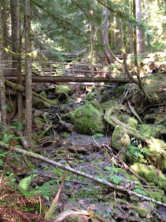
Once we reached our trailhead and signed ourselves in on the register, we tried to match Roxy's enthusiasm as we headed up the trail. It started out fairly benign, but as soon as we crossed the first footbridge, the kid gloves came off and we started up, up, up. I'd like to quickly mention that at the lower portion of the trail, the creekbed is dry. However, further up, Copper Creek is fully flowing. At some point about 1/3 of the way up the trail, the creek hits a fissure and diverts below ground. Cool, right?

It wasn't long before even Roxy lost her enthusiasm. To simply say this trail is steep just isn't giving it credit. It's STEEP. All the way to the top. I'd like to say we powered all the way to the top like locomotives, but I'm really more like the little engine that could. If I don't end up with buns of steel when all this is said and done, I'm going to be really annoyed.


With a great deal of huffing and puffing, we finally made to our destination - the upper ridge of Lightning Peak. It was here we gratefully broke for lunch. The solitude up at the top was almost complete and I could feel absolute serenity wash over me as I dined on my smoked salmon, sharing bits with Roxy.

From inside one of the Brown Mule mines
After a much-needed respite, we again donned our packs and headed back down. If the trip up the trail was tough, the trip down was tougher. In more than one spot we marveled that we had just come up this trail. As usual, I struggled with the down, but not as much as I feared. Every muscle group in my legs, plus a few I didn't know existed, were put to the test on both the ascent and descent. We didn't cut any time off of our climb time on the way down, but picture if you will, going down stairs for 2 solid hours. By the time we got back to Mike's truck, I could no longer feel my knees. I could feel my feet though, and they weren't happy with me - I really need new boots, not that different boots would have helped much on this one. We decided to visit two of the mines on our way down and the coolness of the air within was a refreshing break from the heat of the day, especially since even my sweat was sweating.

This was a good hike and gave me a better picture of where I am physically. I am stiff and sore, but considering the severity of this trail, I expect to be. I am still questioning my ability climb Mt St Helens in September, but my confidence level is being to increase again. I know what trails still lay ahead in our conditioning schedule and I think I'm right on track.

And for the record - I'd hike this one again.

Distance hiked: 5 miles
Elevation gained: 2400 ft

Monday, June 1, 2015

Church Creek

5/30/2015
 
Church Creek trail can pretty much be summed up in one word ... Wow.

Trail descriptions for this trail are few - we had to rely on trip reports from previous hikers and even then they didn't give much of an insight as to what lay ahead of us.

The trail winds its way through some beautiful old growth forest, deep into the Skokomish Recreation Area in the lower Hood Canal district of the Olympics. The serenity was amazing; birds singing in the trees, grouse grump-grumping in seeming cadence with our footsteps, all to the music of running water just out of sight. These were the only sounds that broke the silence. Wow, what a good workout. We were prepared to gain 2330' in 3.2 miles. That elevation-to-distance ratio was in keeping with what we'd been hiking lately, with a slight push on the gain to increase our conditioning. What we weren't exactly expecting was for that gain to come all in the first two miles of the trail, followed by a descent of about 1500' down into the basin where Church Creek originates. We also weren't expecting to navigate the massive trees that had fallen across the trail.

Me, trying to figure out how to get around the massive tree you see behind me.
Oh, but once you make it up and over that ridge into the basin. Wow.


Church Creek originates from a pond, or 'tarn', that was crystal clear and surrounded on all sides by various peaks and ridgelines. It was so clear that you could see the speckled sides of the trout swimming under the surface, and the red bellies of the salamanders that wandered the bottom. We followed the trail around to the far side of the pond where we had lunch and reveled in the beauty and serenity of the basin.

 
After lunch it was back to the trail for our up-and-over return trip. The final descent of the trail made me realize how far I have yet to go on my conditioning. I fell behind Holly and Ken, struggling with the degree of decline. Chris M and Mike hung back with me on the trail. It has shaken my confidence in my ability to handle the descent of Mt St Helens climb, and made me realize that I need to up my game if I'm going to make it.
 
I have added a high-protein powder to my daily fruit smoothies in the hopes of developing some muscle mass in my legs. I am now consuming 60g of protein in the mornings, along with additional amino acids and other muscle building goodies. My weekday workout regime will be adjusted again to concentrate more on building muscle and bumping up my stamina/endurance a bit more.
 
All in all, this was a great conditioning hike with a wonderful payoff at the end of the trail. I plan on doing it again next year, but as an overnight - and I'm bringing a fishing pole.
 
Distance hiked: 6.4 miles
Elevation gain: 2300'